In our last article we explained that we came to the south of France on a whim (understand: we booked the flight not even 12 hours before it took off). Go to this first article on the Castellane region to get all the information on how to get to the beginning of the hike.
After the first day of hiking we arrived in Carajuan, a small campsite just at the entrance of the Verdon Gorges. So it was after a good night's sleep in our tent that we put our bags back on our backs and went to explore the gorges du Verdon.
See you at the Point Sublime
The day before, the path we had taken had reserved a few suspense for us (understand that I thought would die) so it was with a certain relief that I began this day. Since we did not plan this holiday at all, only Benoit had really looked at the hiking trails. That morning, he started describing me the trail in the following way:
"We follow the road for a short while, then it's a very flat path that runs along the river in the gorges for 13km. At the end we will have just a small climb of 300m of difference in altitude, but that's all! »
Call it love, blind trust or naivety, but I was very cheerful when I set out on my journey!
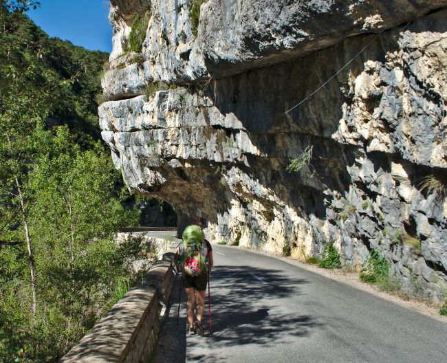
The first part of the hike is not the most spectacular. From the Carajuan campsite, we have no choice but to follow the road for about 4.5km (200m of positive altitude difference) to reach the beginning of the Martel trail. Fortunately, early in the morning there is not yet too much traffic on this narrow and winding road. In other words, it is without too much trouble that we arrived in less than an hour at the beginning of the Martel trail!
The Blanc-Martel Trail
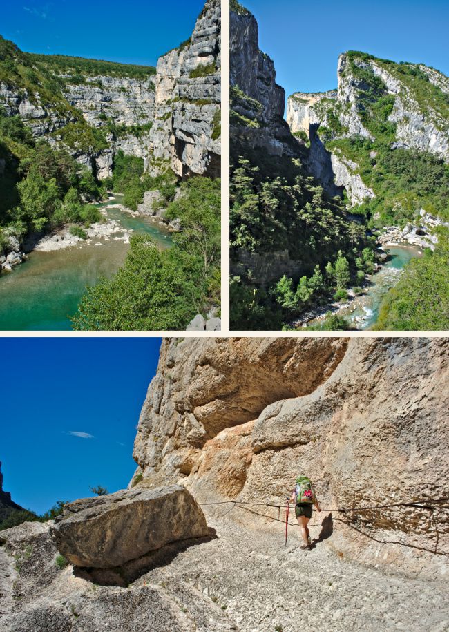
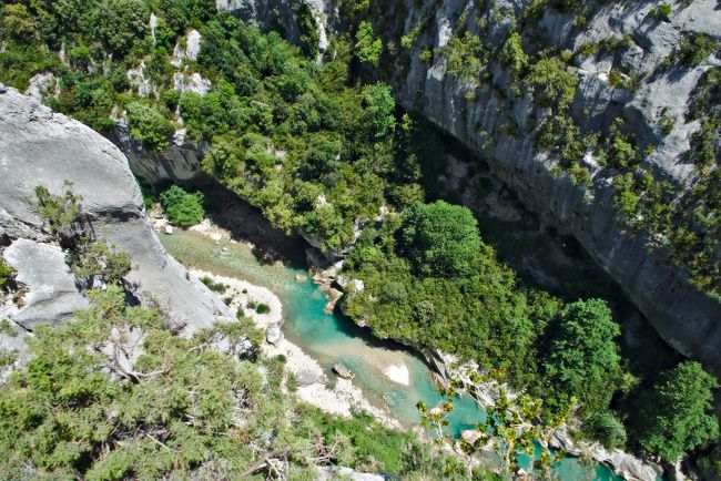
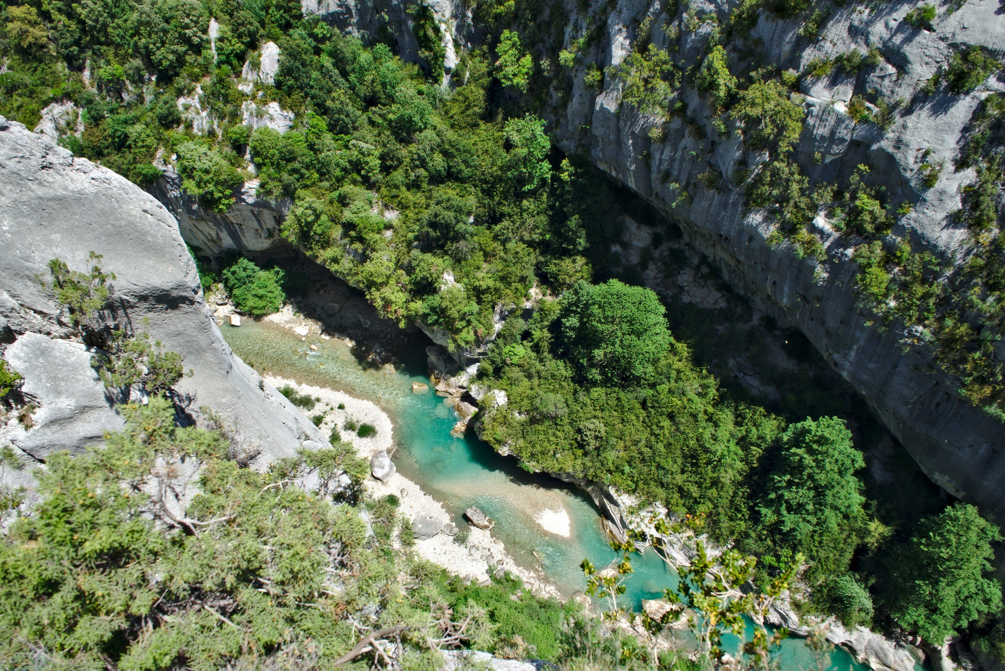
From the parking lot of the "Point Sublime" we start by going down stairs and very quickly we arrive in the heart of the gorges! Wow, the least we can say is that it's simply impressive: huge rock walls standing in front of you and emerald water flowing in the middle.
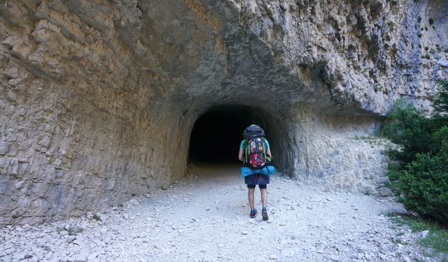
At the very beginning of the hike we start by crossing 2 tunnels. The latter were originally built in 1890 as part of a hydroelectric project, but this project was abandoned because of the war. The tunnels being there, they are now used by hikers! On the other hand, a headlamp is strongly recommended because the first tunnel is still 670 meters long, which means that we are plunged into total darkness!
The trail
The Blanc-Martel trail is really a very pleasant path, we progress along the water by alternating the passages where we are sometimes almost at the water's edge and sometimes directly above where we overlook the river by several hundred meters (in other words, Benoit's theory of the "flat path" has not been verified at all! In fact it turned out later that he had decided not to take the paid option of the application he was using to make our itinerary and that as a result the elevation changes were missing... hmmm)
 The Imbert Breach
After about 3 hours of walking (and many photo breaks) we reach the famous point of the Imbert breach.
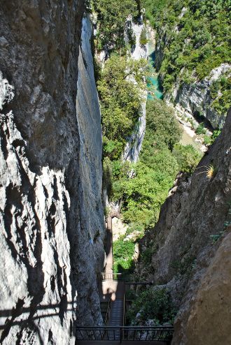
In fact, it is 252 steps of stairs that allow you to climb 100m of vertical drop in no time.
The Imbert breach has the reputation of being a delicate and even dangerous spot... So it's certainly quite impressive, but although I'm not particularly comfortable with the void, it didn't cause me any issue: they're not ladders strictly speaking but stairs with safety barriers around them.
(go figure, I probably remained traumatized from the ladders we had crossed in China in the tiger leaping gorges, so I'm more difficult to impress... To see these famous ladders again, it's in the video over here)
Direction la passerelle de l'Estellier
From the Imbert breach on, the path is rather going downhill (I say rather, because in the end I have the impression that we climbed and descended the whole day) until we reach the crossing where hikers will have the choice between going up to the chalet de la Maline (parking) or continuing to the footbridge of the Estellier. So we headed towards the footbridge to cross the Verdon one last time before going up the other side.
Infos
To reach the beginning of the Martel trail from the campsite the best is to follow the road that goes down on the left after the tunnel (about 3.5kms from the campsite).
If you are by car: be aware that during the high season there are shuttle buses that connect the chalet de la Maline and the Sublime point so that you can return to your vehicle at the end of the hike. More information here
Be careful, out of season the shuttle only runs on weekends.... But at worst you can still hitchhike, there is really a lot of traffic in the area and hikers are gladly taken.
The Imbut trail
Before going back up, we decided to make a small detour on the trail "de l'Imbut".
The Imbut trail is probably one of the most spectacular hikes in the Verdon gorges, but it is also the most technical part.
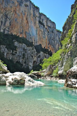
Known for its narrow paths in the cliffs, air passages, but also the relatively slippery and unstable terrain this is clearly a path reserved for good hikers.
For us (okay, let's be honest for me), it was out of the question that we would go into this with our big backpacks on our backs. I'm not a queen of balance in normal times, so I probably wasn't going to get into this with 12 kilos on my back! 🙂
What we did was leave our big bags out of sight on the side of the trail and explore a little bit the beginning of the trail.
For me the exploration will have stopped a few hundred meters from the crossing when we came across a beautiful little sandy beach! Benoit decided to push a little further and set off alone on this trail. He came back an hour later, conquered by the landscapes but also with a little smile on his face and he told me:
«you did the right thing by staying here... It's not really a path for people who are prone to vertigo! »
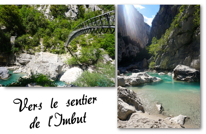
If you wish to do the entire Imbut trail, it is essential to start either at the Auberge des Cavaliers or at the chalet de la Maline. At the end of the Imbut you have to leave the gorges and take the Vidal path. This trail is so steep that it is forbidden to descend it!
Sleeping on the edge of the European Grand Canyon
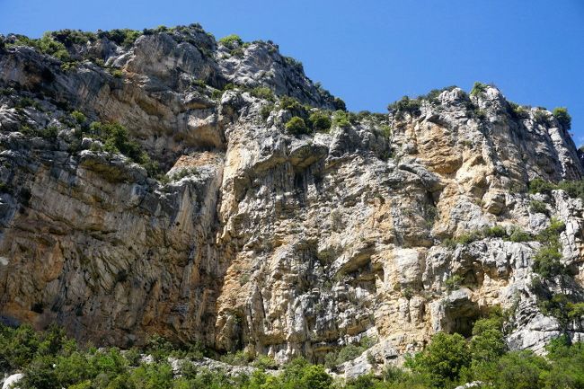
Once my man returned from his exploration and I rested well, we started the last climb of the day! On the program: 240m of altitude difference over a distance of.... 700m ! I might as well tell you that it's climbing fast, but nothing very insurmountable. At a good pace and keeping a constant rhythm we reached thetop in a little half an hour.
We had seen on the internet that there was a hotel at the top of the gorges, the Grand Canyon du Verdon Hotel and since the sky was starting to get darker and darker we preferred to opt for a night in a good cozy bed rather than unfold our tent!
Well, in the end we were right! Because while we were enjoying our dinner with a breathtaking view of the gorges, a powerful storm came to rinse the surroundings... We were very happy to be safe and dry! 🙂
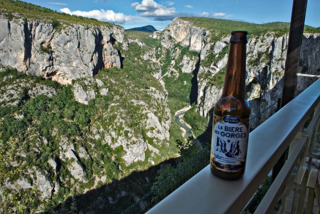
The Grand Canyon Hotel is really the ultimate perfection for hikers: The hotel is certainly a little old but frankly enjoying a beer with a panoramic view of the day's route it's just the best!
Infos
Hiking from Carajuan to the Grand Canyon Hotel
- Distance : about 16km (without counting the "sentier de l'Imbut")
- Elevation gain : about 1100m
- Elevation loss : about 500m
- To take with you : in the gorges there is no possibility of buying food. It is therefore necessary to bring a picnic and at least 2 litres of water per person. Don't forget the headlamp for the tunnels at the beginning of the trail.
- Hotel du grand canyon Price of half board: 140€ for 2 people (including night, dinner and breakfast)
Attention: We arrived without reservation, but we were also out of the main tourist season. Contact them for more info
Ascension of the Grand Margès
The next morning we left early to attack the main course of this hike: the ascent of the Grand Margès.
Once again, map reading has not been our strongest asset. We knew we were going to start the day with 800m of positive altitude difference, and honestly we were prepared to sweat a lot! In the end, the climb turned out to be much easier than expected. Only one part in the forest was really steep, but the rest of the climb was relatively easy.
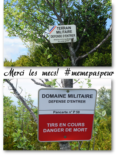
When the hike crosses a military area
Well... personally I was only a moderately relaxed when we started to see signs every 300m telling us that we were in a military area...
We were on a GR, so a fully authorized hiking trail, right?
But apparently a military base is not far away, and the least we can say is that they do not skimp on the means to ensure that hikers do not leave the trail!
I guarantee you that when you see these signs every 300 meters you don't even want to walk away from the trail for a pee break! 🙂
The ultimate reward at the top!
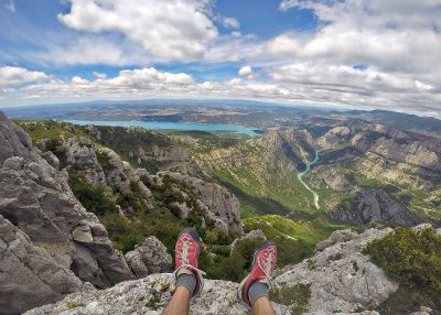
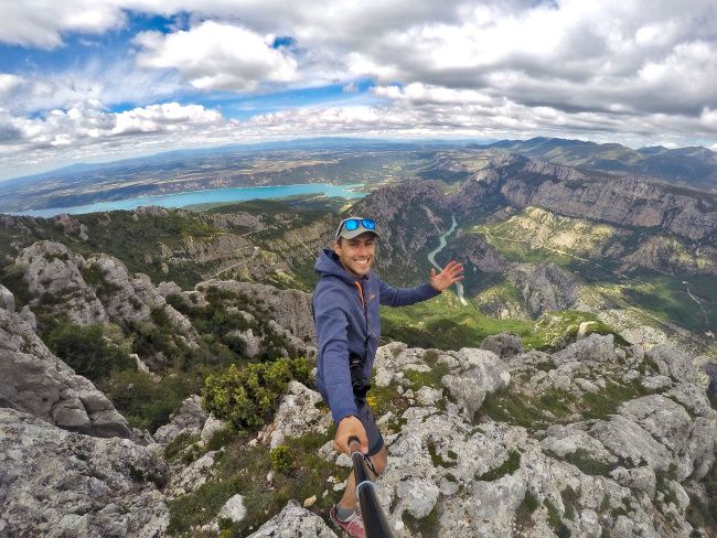
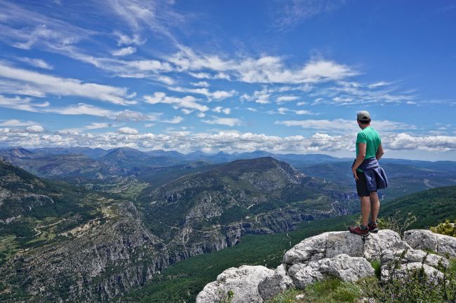
As is often the case when tackling a good climb, the ultimate reward is the view from the top! And how to say.... We were clearly not disappointed! A 360-degree panorama of the Alpes de Haute Provence, the plateau and of course the Gorges du Verdon. A dream picnic spot!
Descent towards les Aiguines
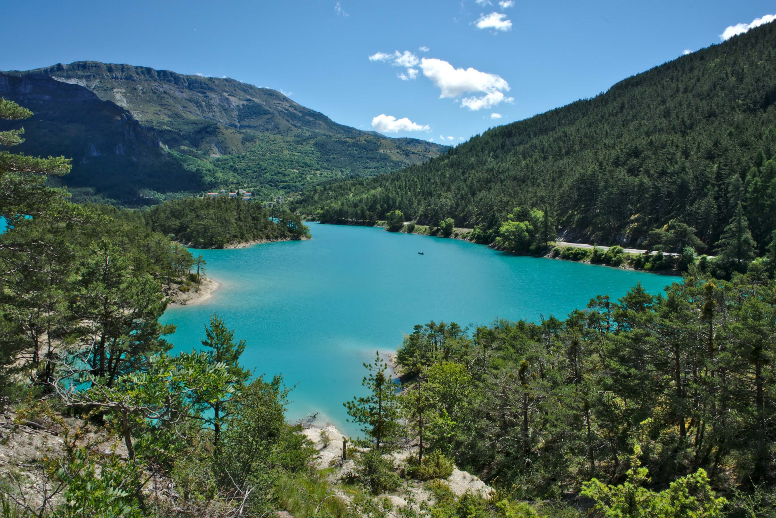
From the top of the Grand Margès, the descent to the Aiguine is easy, even if it is relatively long and with the packs on the back it tends to hurt a little in the knees... But honestly it is well worth it, because as you go down, you can enjoy a spectacular view of Lake St. Croix!
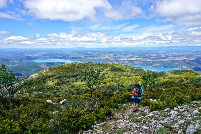
While we were still going down into the forest and seriously starting to wonder if this descent would ever end, we heard the sound of church bells: The village of Les Aiguines was not far away!
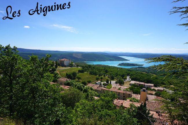
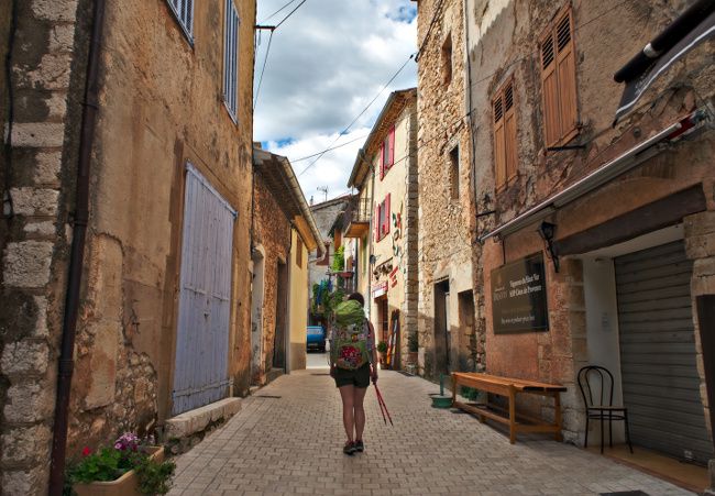
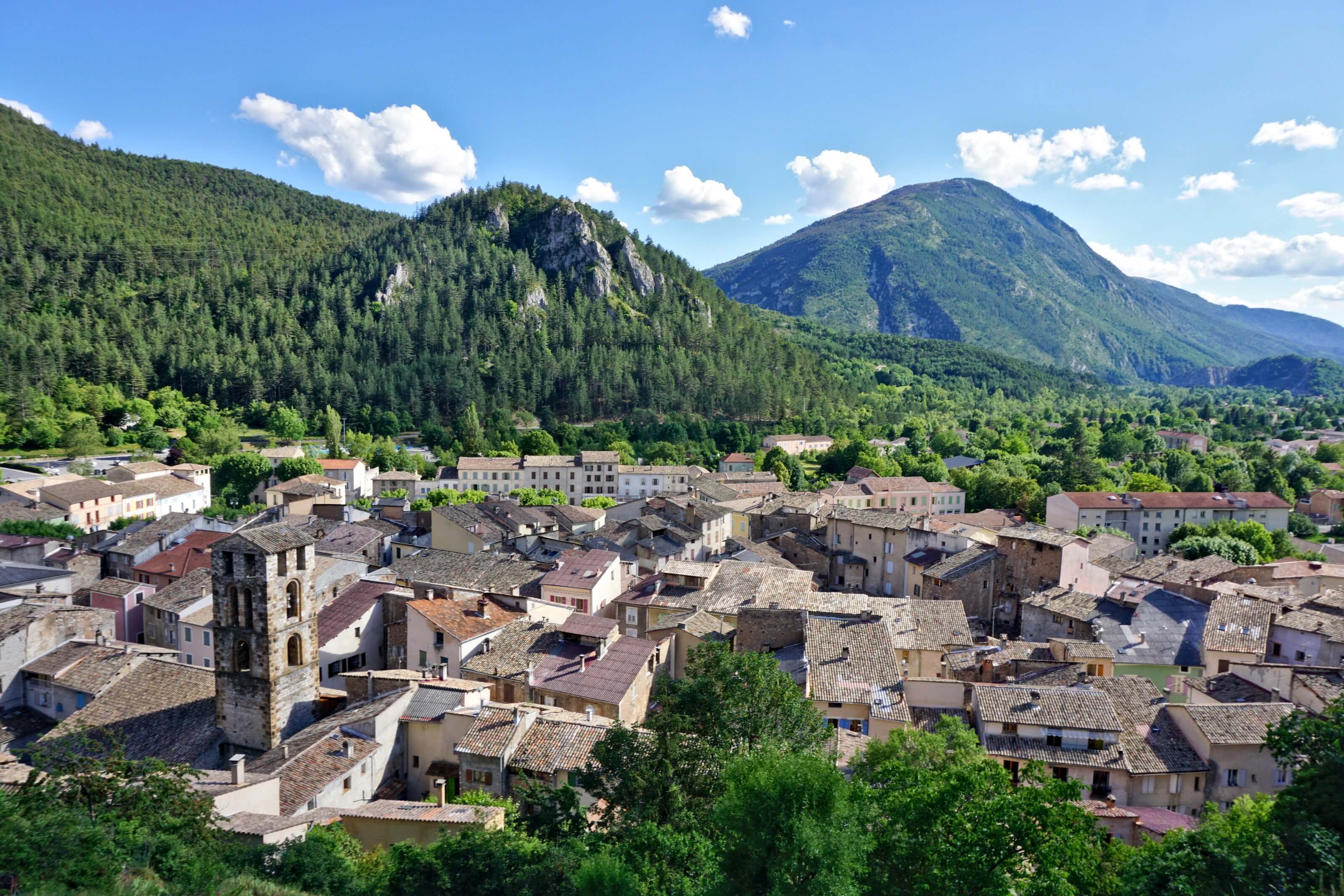
Les Aiguines is a small village in Provence as we imagine it (at least that's exactly what I had in mind!). Small narrow alleys, shopkeepers all sitting outside, shaded terraces in the centre of the village with a few grandpas with a southern accent sitting around a bottle of rosé from the area!
It didn't take much more for us to take a well-deserved break on a terrace! We had really sore muscles, but we were also pretty happy with this beautiful day.
Overnight at Lake St. Croix
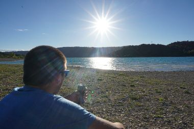
We hesitated to sleep in Les Aiguines but finally decided to push a little further and attacked the last kilometers to reach the Galetas campsite located by the lake. Putting aside the fact that we got miserably lost on the way and found ourselves crossing a forest to reach our destination, the descent was quite easy. 🙂
We spent the rest of the day enjoying the last sunrays on the beach with a well-deserved beer.
Infos
Hiking from the Grand Canyon Hotel to Lake St. Croix
- Distance : about 18 km
- Elevation gain : about 800m
- Elevation loss: about 1000m
- Camping Galetas : Price per tent (for 2 people) : 15,20€
Possibility to buy food at the shop and there are several restaurants on the beach.
below the map of our hike in its entirety:
Note: For this hike, we recommend that you download the trail to have it with you on your smartphone/connected watch. To do so, you simply need to have an account (free) on AllTrails and you will be able to download our map.
So that's it for now! We are preparing a last article on our week in the south of France. See you soon!
Other articles about this hike:
NB: Please note that this article contains affiliate links to partner sites. If you buy a product on one of their sites you will not pay more but we will receive a small commission. This will help us to keep this site alive. Thank you! 🙂
 The Imbert Breach
Hi guys! This hike looks absolutely incredible. Are the trails well marked along the way?
Hey Nikki, yes the trails are super well marked and easy to follow. It’s a really nice hiking area!
Hello, is it necessary to spend a night in the hotel during the hike or can the first half be done in a day and come back then do the other half during an other? Or if we start early can the hike be done in 1 day without being divided into two? Thanks for your help 😀
Hi Zoubida,
Well it’s 56kms so if you want to do the exact hike we did in one day, it’s going to be more a trail than a hike (and a tough one 😉 ). but yeah, you can always do a part and come back later to finish the hike. The only thing is that I don’t think there is any public transportation in the area
Hi,
Is it possible to camp out on all the nights?
And is there any prohibition of lighting a portable burner in any if the places?