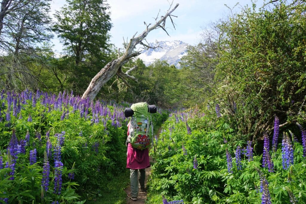
Exploring Patagonia in spring turned out to be more challenging than expected, especially when it comes to hiking trails… To give you an idea of the challenges this season brings, here’s our account of 4 days spent hiking in Pampa Linda in Nahuel Huapi National Park, after visiting San Carlos de Bariloche.
We made this trip to Pampa Linda in 2014, but the article has been completely revised and updated in February 2025. If you notice any price changes or have additional information that might be relevant, please don’t hesitate to leave us a comment!
Hiking in Patagonia in spring
Snow: the main challenge
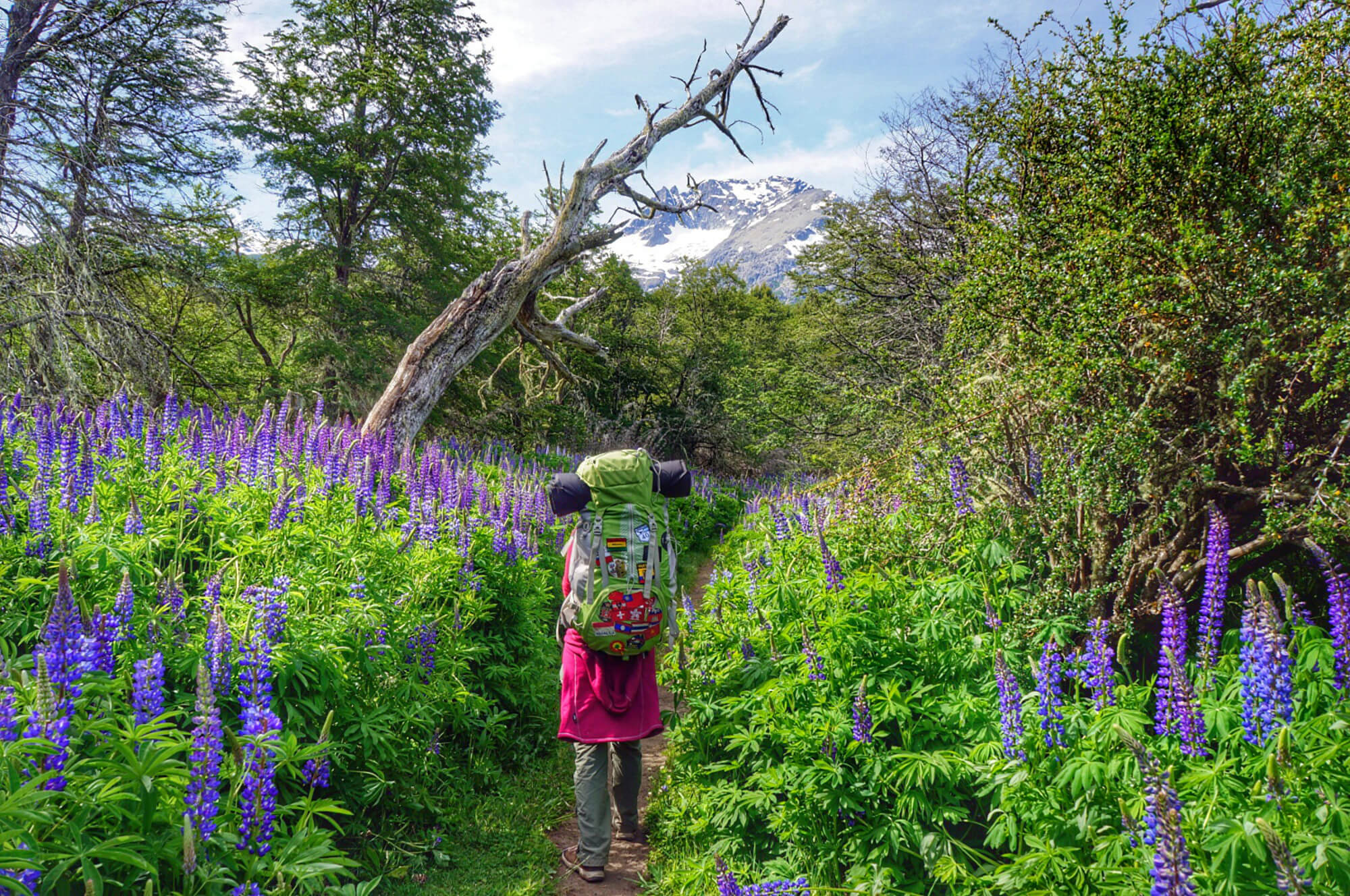
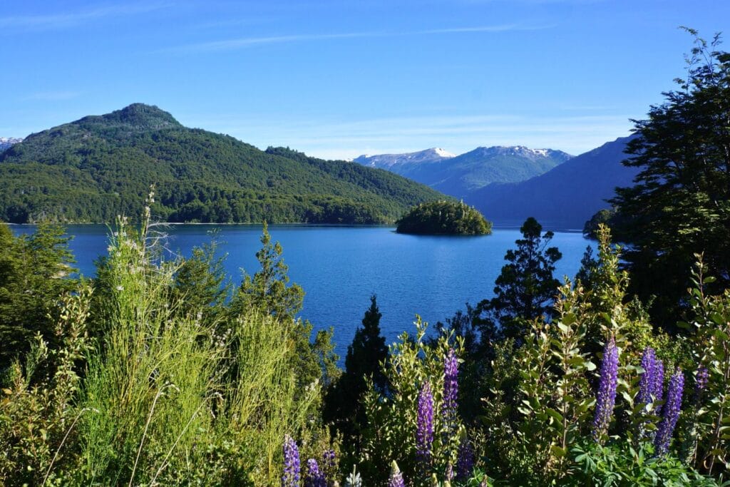
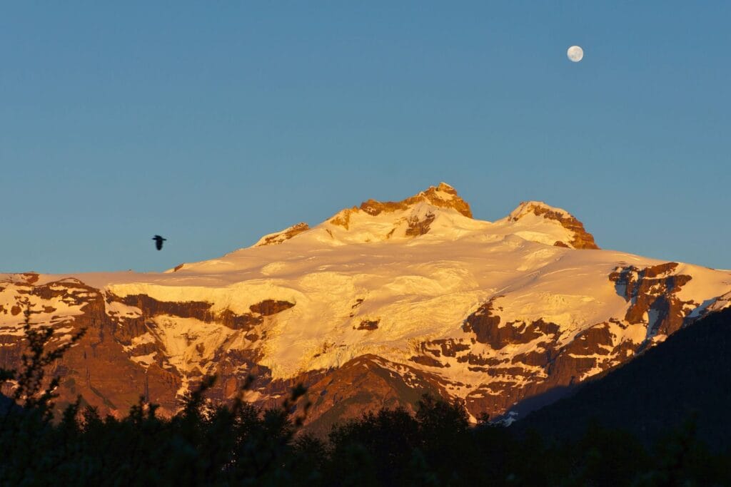
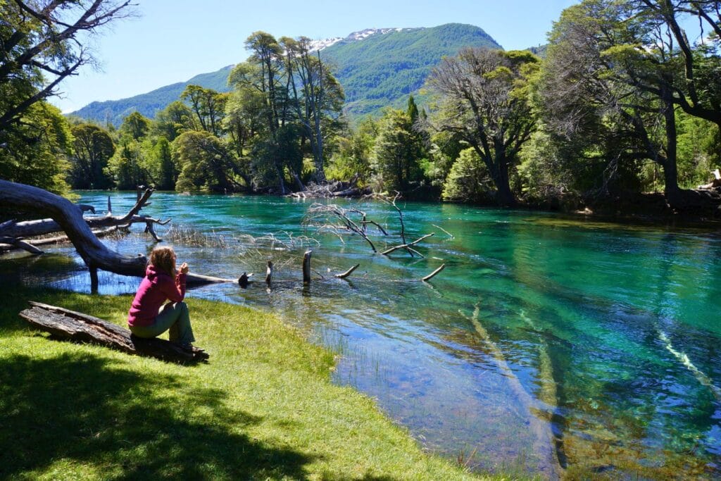
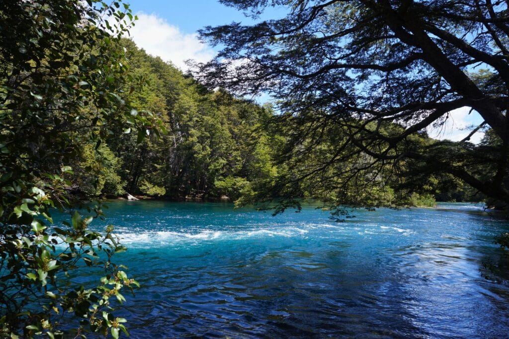
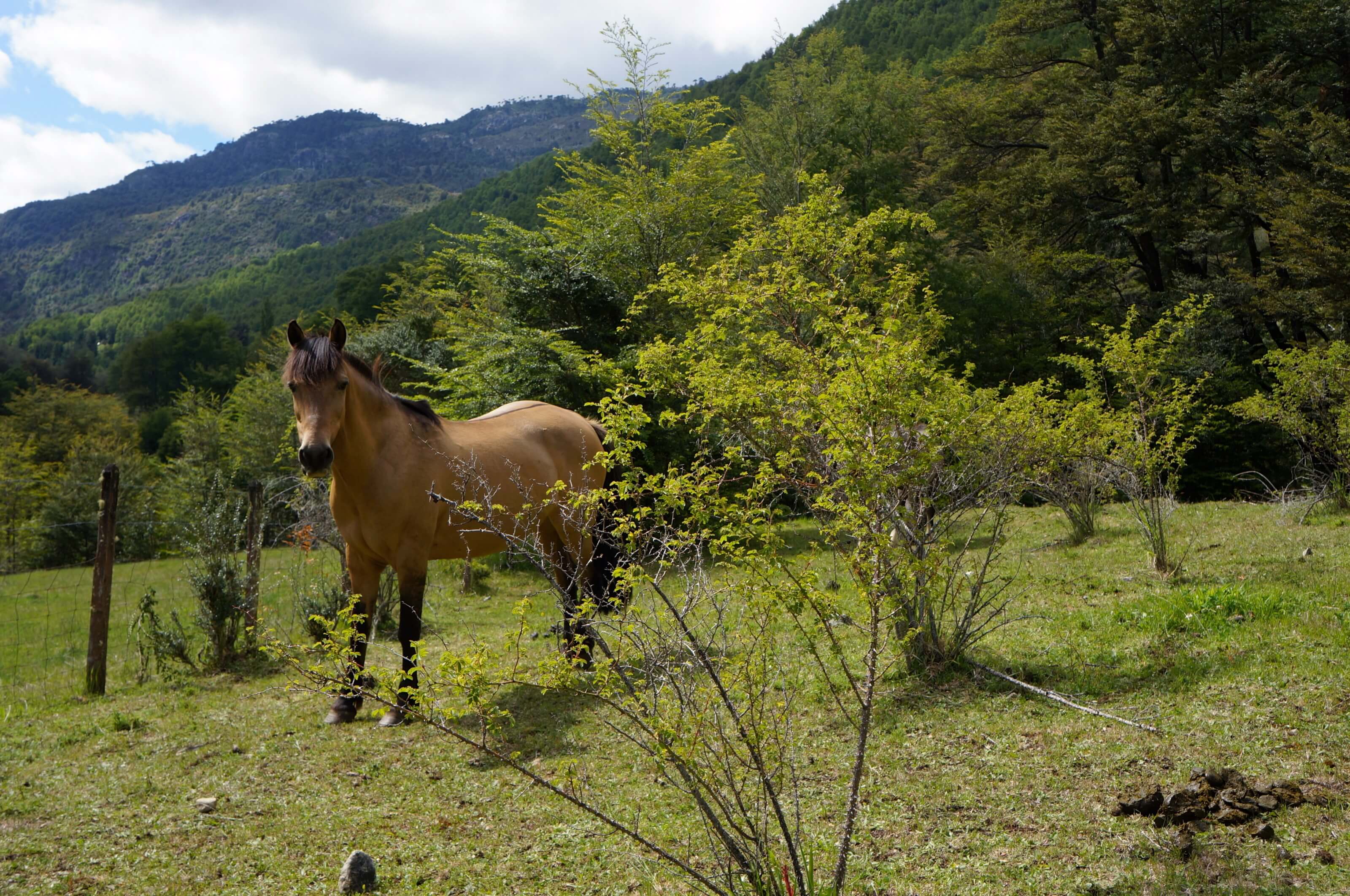
The main attraction around the small town of Bariloche is Nahuel Huapi National Park and the magnificent landscapes it protects. On the menu: Andes mountains, turquoise lakes, crystal-clear rivers, waterfalls, Andean condors, and other wildlife… In short, it’s a hiker’s paradise!
But where there are mountains, there’s snow! In Patagonia, spring officially lasts until December 21st. We, being naive, read in the guidebook “December-April: ideal period for trekking around Bariloche.” So we thought we could probably do whatever trek we wanted in Nahuel Huapi National Park… Rookie mistake ;)!
Initially, we planned to do the Traversia 4 refugios (Nahuel Huapi traverse), which connects Refuge Frey to Refuge Lopez in 4-5 days. This trek through the park’s most mountainous section promised to be beautiful. Well, we quickly had to change our plans… Even though the trails accessing different refuges from outside the park are open, the trails connecting the refuges through the mountains are mostly closed until January… Between Jakob and Laguna Negra refuges, there’s sometimes even snow until February! Bottom line for us: impossible to hike above 1,500m in December. So we went looking for other options.
Snowmelt
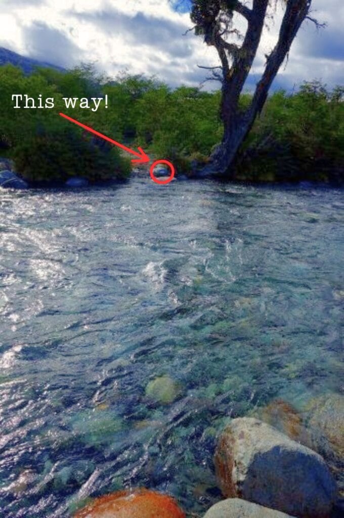
To be honest, we hadn’t seen this one coming! In spring, with snowmelt, rivers are running high (no kidding!). To avoid getting stuck mid-hike, check your map to see if your planned route crosses any rivers. Generally, there are no bridges for crossing (this isn’t Switzerland, after all!). While we’re not afraid to take off our shoes to cross streams – we did it during our trek in Vicente Pérez Rosales Park – when you find yourself facing an 8-meter wide river, 1 meter deep, with strong current and ice-cold water, you think twice before crossing!
To avoid this problem, there’s no magic solution, given how extremely difficult it is to find reliable information about trail conditions. If you’re hiking in Patagonia in spring, avoid rivers as much as possible!
Finding reliable information
As we were looking for a backup plan and information about accessible trails in the park, we naturally went to the park rangers’ office in Bariloche. But just like with CONAF in Chile, we left the office not much wiser than when we went in. The staff member couldn’t even tell us at what altitude we’d start encountering snow and had absolutely no idea about trail conditions. Not very helpful, to say the least!
So we figured the best way to assess conditions was to do a day hike ourselves to one of the refuges, the Frey Refuge trail.
This turned out to be the right move – we discovered we could easily hike up to 1,500m without snow. Plus, we got to chat with the Frey Refuge caretaker who knew absolutely everything about what’s possible to do in the national park. The 10-minute conversation we had with him was more useful than the hours we’d spent in Bariloche and on the internet! After this exchange, we decided to head to Pampa Linda, at the foot of Tronador Volcano, to do some hiking in that area.
Pampa Linda, heart of Nahuel Huapi National Park
National Park overview
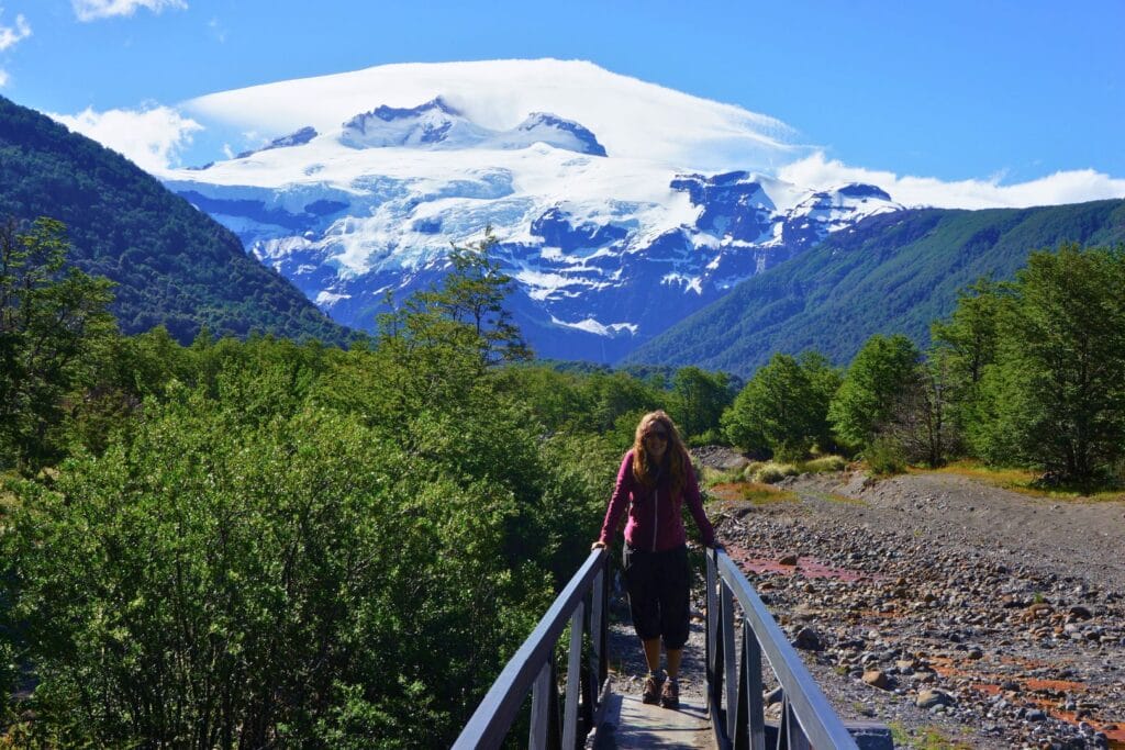
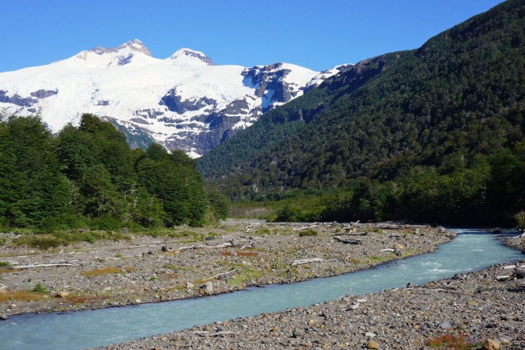
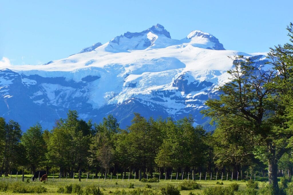
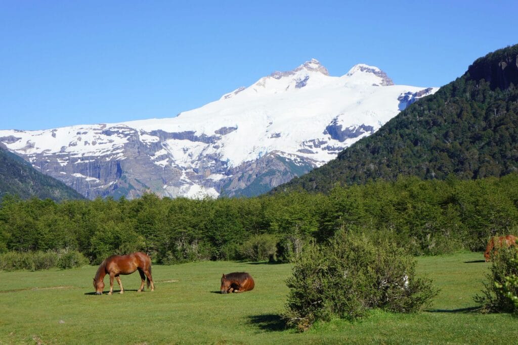
Tronador Volcano is truly the master of Nahuel Huapi National Park, towering at 3,478m altitude, almost 1,000m higher than surrounding peaks. It was named (literally “the one that rumbles”) because of the sound of ice breaking off from its 7 glaciers before crashing to the ground in a thunderous roar that echoes throughout the valley.
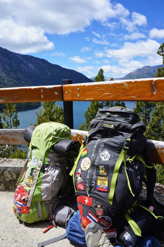
The best way to admire this volcano and its impressive ice falls is to go to Pampa Linda, the base for hiking and trekking in the area. This little paradise consists of just one hotel, 2 campsites, and the ranger station! The advantage is that it’s located barely 8km from the foot of Tronador. For hiking trails, there are enough to delight all hikers regardless of your level: high-altitude hikes, one or two-day trips, or longer treks. So, we packed 4 days of food in our backpacks and off we went!
How to get to Pampa Linda
Pampa Linda is 80km from Bariloche (2 hours by road), and to get there, you can take the bus organized by Club Andino Bariloche (CAB) if you haven’t rented a car. You need to book through the club, and the shuttle runs between November and April. One catch though – it’ll cost you the hefty sum of 30 euros one way… Crazy, right?
So instead, we hitchhiked on Route 40 from the outskirts of Bariloche to reach the Nahuel Huapi Park’s entrance at Lake Mascardi, at the village of Villa Mascardi. From there, it’s another 40km of dirt road to Pampa Linda. Here too, we barely had to walk. Since most tourists driving through there are heading to Pampa Linda, they’ll be happy to give you a ride if you flash them your best smile!
Important timing note if you’re going by car! 30km before Pampa Linda, at the Los Rápidos junction, the road has specific hours and is closed by a barrier outside these times! It’s open between 10:30 a.m. and 2 p.m. for access to the Tronador base (Bariloche to Pampa Linda direction). In the opposite direction, returning to Bariloche, the road is open from 4 p.m. to 6 p.m. Between 7:30 p.m. and 9 a.m., the road is open in both directions. So plan your timing carefully ;)! These last 30km are also a bit rough in terms of road conditions…
If you don’t have a car and prefer having a guide to visit the national park from Bariloche, Civitatis offers a day tour that takes you to the main points of interest.
Where to stay in Pampa Linda
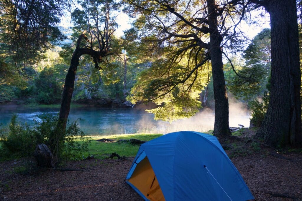
In Pampa Linda, there’s only one hotel, the Hostería Pampa Linda. We didn’t try it as we preferred camping! If you have your tent, it’s an excellent compromise to be close to everything with the comfort of a shower. You’ll find 2 campgrounds in Pampa Linda:
- Los Vuriloches campground next to the hostería, where we stayed. The pitch costs 20 euros per person with access to bathrooms, barbecues… For more information, visit their website.
- Río Manso campground located 200 meters down, just before the river. The price is 4 euros per person but there are no showers.
Hiking trails map in Nahuel Huapi National Park
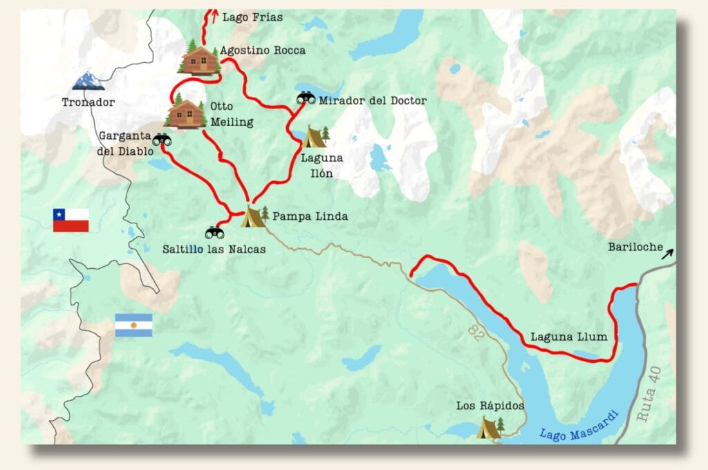
The first map gives you an overview of the park’s trails. You’ll find more detailed maps below. For all the hikes detailed in this article, I’ve added a button to directly download the track to your smartphone/smartwatch. Simply create a free account on AllTrails, and you’ll have access to all download formats of your choice.
Note: Entry to Nahuel Huapi National Park is fee-based: 20,000 pesos per person. You can buy your ticket online or on-site (cash only) on Route 82 leading to Pampa Linda. Also, before hiking, remember to fill out the registration form. It’s mandatory for almost all hikes! In case of problems, this helps rescue services be more effective.
This article contains affiliate links to partner sites. When you use our links to book accommodation, a car, or an activity, you don’t pay anything extra, but we get a small commission. This helps us to offer you free, independent, and ad-free content. Thank you for your support!
Mirador Garganta del Diablo
- Distance: 20.5 km
- Duration: 5 h
- Elevation gain: 860 m
- Difficulty: easy/intermediate
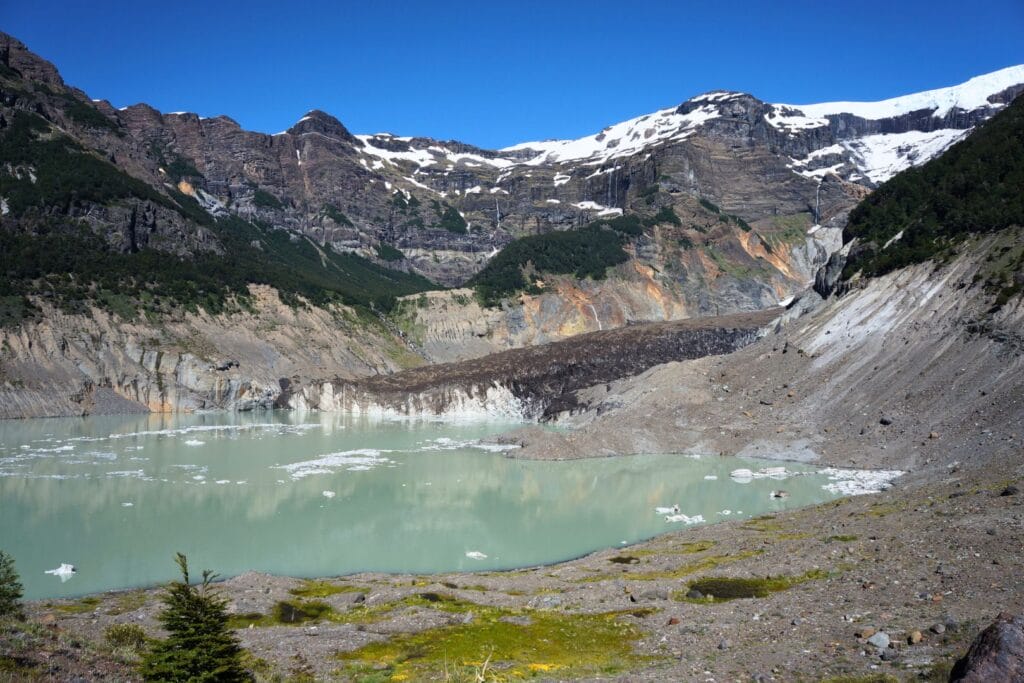
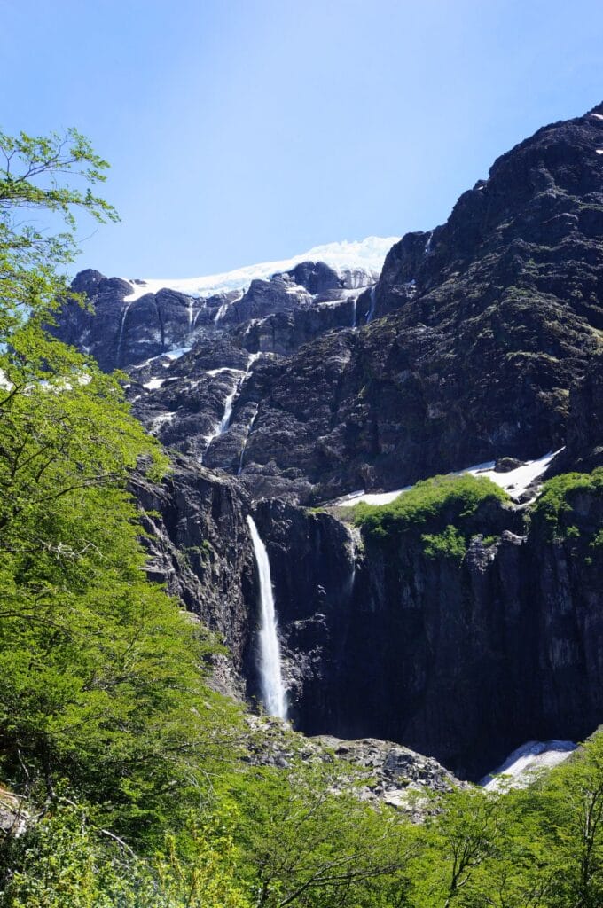
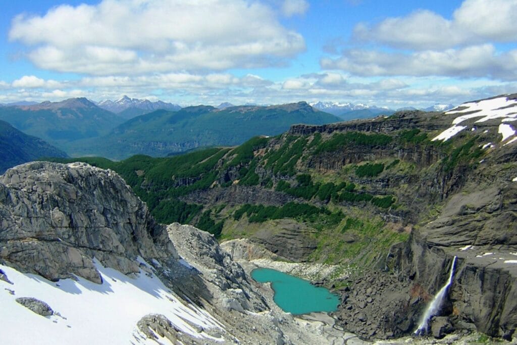
Located 8 km further along the trail passing through Pampa Linda, the Devil’s Gorge is essentially Cerro Tronador’s lair. After passing the viewpoint over the Ventisquero Negro glacier, you’ll find yourself at the foot of this giant. You can admire up close the ice falling and crashing down with a deafening roar. If you’re lucky, you might also see majestic Andean condors flying overhead. Before traveling to Patagonia, we’d never had the chance to see them in the wild. We saw them several times here and previously when we were in Pucón in Huerquehue Park. It’s simply impressive!
The round trip from Pampa Linda to Garganta del Diablo can easily be done in a day on foot. But if you can catch a ride for part of the way, don’t hesitate! Walking the same path twice on the dirt road isn’t the most interesting part.
Oh yes! At the end of the trail is Restaurante Los Ventisqueros, a restaurant/café that makes amazing (though not cheap) cakes! We had a slice of brownie/dulce de leche/meringue cream pie that was simply incredible (though at 4 euros a slice). Just goes to show you sometimes have to go to the most remote places to find the best cake!
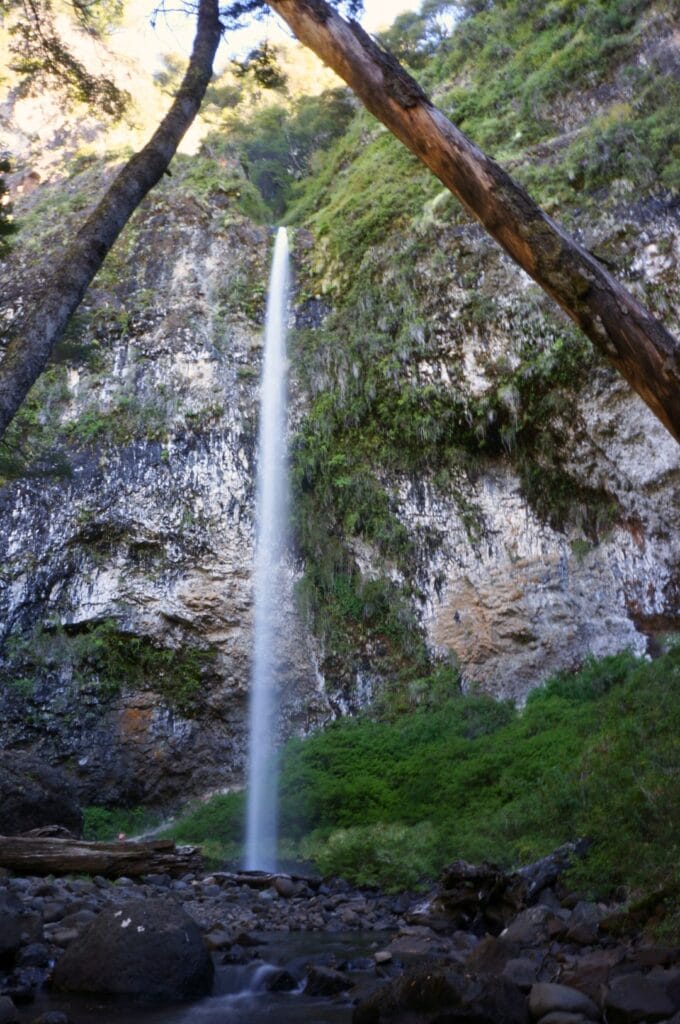
Saltillo las Nalcas
- Distance: 3 km
- Duration: 1 h
- Elevation gain: 100 m
- Difficulty: easy
This pleasant short walk begins 900m after Pampa Linda, on the left side of the road leading to Garganta del Diablo. The path takes you to the pretty Saltillo Las Nalcas waterfall in the middle of the forest. Everything is well marked up to the waterfall. Note that this is also where the path that crosses the border to Refugio Viejo begins, the old refuge that served as a base for climbing Tronador. Since it takes no more than an hour to reach the waterfall, you can easily do this on your way back from Garganta del Diablo.
Refugio Otto Meiling
- Distance: 25 km
- Duration: 8 h
- Elevation gain: 1100 m
- Difficulty: Intermediate
Located 5-6 hours of walking above Pampa Linda at 2,000m altitude, the Refugio Otto Meiling is probably the best place to admire the Tronador volcano and the glacier. Since we weren’t equipped for walking in snow, we didn’t go up to the refuge. However, we met a group coming back from there, and it’s apparently worth the detour. They told us they were able to observe condors up close and had an incredible view of Tronador. Half-board – night at the refuge, dinner, and breakfast – costs 71 euros. The refuge also offers camping spots, but be careful of the conditions up there!
If you’re a good hiker, this trek can be done in one full day if you start early for the round trip.
Laguna Ilón (and Mirador del Doctor)
- Distance: 15.6 km (24 km)
- Duration: 4-5 h (8-9 h or 2 days)
- Elevation gain: 650 m (1150 m)
- Difficulty: Intermediate
We really hesitated about doing this trail! Laguna Ilón is about 5-6 hours of walking north of Pampa Linda. This trek can be done as a 1 or 2-day trip by going up to the Mirador del Doctor and staying at Refugio Laguna Ilón or the campsite. Check rates and book on their website. Another possibility is to do a 5-day trek connecting to Cerro López, part of the Traversia 4 refugios, or join the Refugio Agostino Rocca at Paso de las Nubes (Cloud Pass) and make a loop with the Otto Meiling Refuge. Really, anything is possible!
Note: The section between Rocca and Meiling refuges requires a guide as the trail crosses the Alerce glacier.
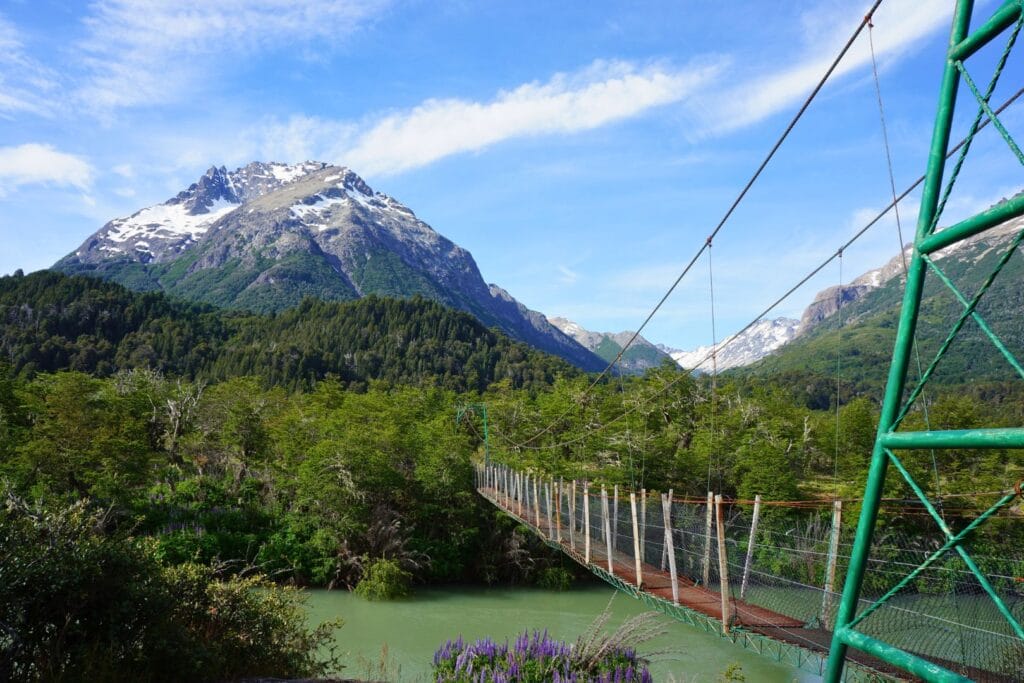
Lago Frías
- Distance: 23.5 km
- Duration: 2 days
- Elevation gain: 870 m
- Difficulty: Intermediate
Count on 2 days to reach Lake Frías from Pampa Linda via Paso de las Nubes. The advantage is that once there, you can take a boat that will take you directly back to Bariloche through the Brazo Blest arm of Lake Nahuel Huapi. Though this little cruise does cost about 60 euros per person.
You can even make this a 3-day trek by first going through the Otto Meiling refuge. However, you’ll still need a mountain guide to cross the Alerce glacier between Meiling Refuge and Agostino Refuge.
Laguna Llum
The hike
- Distance: 23.5 km
- Duration: 2 days
- Elevation gain: 870 m
- Difficulty: Intermediate
Going via Laguna Llum was our chosen solution for returning to Bariloche in a nice 2-day trek. The path starts 18 km before Pampa Linda, at Los Cesares campground, at the end of Lake Mascardi’s Brazo Tronador. This trek allows you to reach Route 40 on the other side of the lake in 2 days. From there, the idea was to hitchhike or take a bus back toward Bariloche. But, as I’ll explain, things didn’t exactly go as planned… again!
The detour
Of course, the path leading to Laguna Llum follows Lake Mascardi and crosses several rivers. We’re in Patagonia, in spring… Can you guess what happened ;)? After walking 18 km and camping there, we found ourselves blocked at the very first river the next day. Pretty frustrating!
We spent quite a while looking for a good crossing point, without success. So, our only option was to backtrack to the start of the trail and return by hitchhiking or walking along Road 81 to the park entrance and Route 40. This time, we had less luck with hitchhiking and it took us 2 days to get back to Ruta 40.
On the bright side, we found an amazing spot by the Río Manso at Los Rápidos campground to console ourselves for not finishing the hike and not seeing Laguna Ilón, which we would have done if we hadn’t chosen to return via Llum.
Here’s the map of the hike we finally took:
Final thoughts on hiking at Pampa Linda
In the end, over the 4 days, we hitchhiked to Pampa Linda, hiked to Garganta del Diablo, passed by Saltillo de las Nalcas, got blocked by the river, backtracked 18 km to the start of the Laguna Llum trail, and finally returned to the park entrance over 2 days. It wasn’t quite the program we had imagined! But we still got to see some incredible sights and learned a few things for future hikes. 😊 Not such a bad outcome, right?
Key takeaways before hiking around Tronador Volcano:
- It’s spring until January or even February in Patagonia. Don’t forget to factor in snow, which can greatly influence your hiking choices.
- Check if your intended trails cross rivers, and if so, try to get information about water levels.
- Once again, we found it difficult to get reliable information about trail conditions. Don’t hesitate to do a reconnaissance day hike to assess things yourself.
So there you have it – there are enormous hiking possibilities around Bariloche. Nahuel Huapi National Park is splendid and offers truly varied hikes away from the crowds. Are you planning to explore other sections? Don’t hesitate to leave us a comment to tell us what you thought of this little corner of Argentine Patagonia! Meanwhile, we’ll see you in Chile for a 9-10 day hike in Torres del Paine Park with friends – one of the biggest challenges of our trip – and then on to El Chaltén, Argentina’s other hikers’ paradise! Let’s goooo!
Pin it
Join the discussion