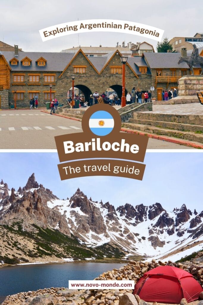
Next step in our Patagonian adventure, and what a treat it is! No, I’m not talking about Argentinian beef… Although… After getting our first taste of northern Chilean Patagonia in the Pucón region, then in the magnificent Vicente Pérez Rosales National Park, we’ve now arrived in Argentina! Bariloche is a small town in Argentinian Patagonia, right in the heart of the Lake district and Nahuel Huapi National Park. Ready for a tour?
We took this trip to Bariloche in 2014, but the article has been completely revised and updated in February 2025. If you notice any price changes or have additional information that might be relevant, please don’t hesitate to leave us a comment!
Introduction to Bariloche
Chocolate, beer, and hiking
San Carlos de Bariloche, to use its full name, is known in Argentina and Chile as the “Little Switzerland of Argentina.” It’s also one of the most popular ski resorts in South America! But since the seasons are reversed in the southern hemisphere, it’s currently summer in Patagonia. So no skiing for us… Sniff! However, we couldn’t miss the opportunity to discover more of the region and all the hiking spots!
During our journey through Peru and Bolivia, we met several travelers who had already been through Patagonia and Bariloche. Since nothing beats the opinion of fellow adventurers, we tended to ask people about the region, their recommendations… The common thread in these conversations was always:
Well, Bariloche is pretty, but for you Swiss folks, it’s probably not very interesting. The landscapes are the same, there are chalets and chocolate.
Ah! But you see, Ben and I are stubborn, and we still decided to check it out! And we’re glad we did! Indeed, dear readers, there is a “little Swiss flavor” in the area. But to say the region holds no interest for the Swiss, well, that’s really stretching it too far!
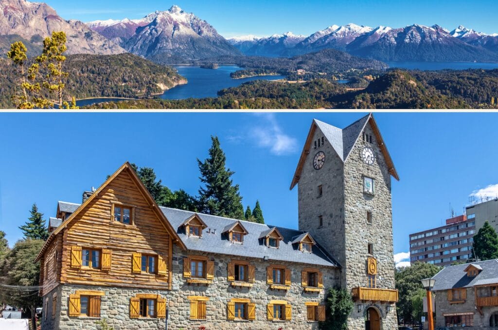
The region around Bariloche
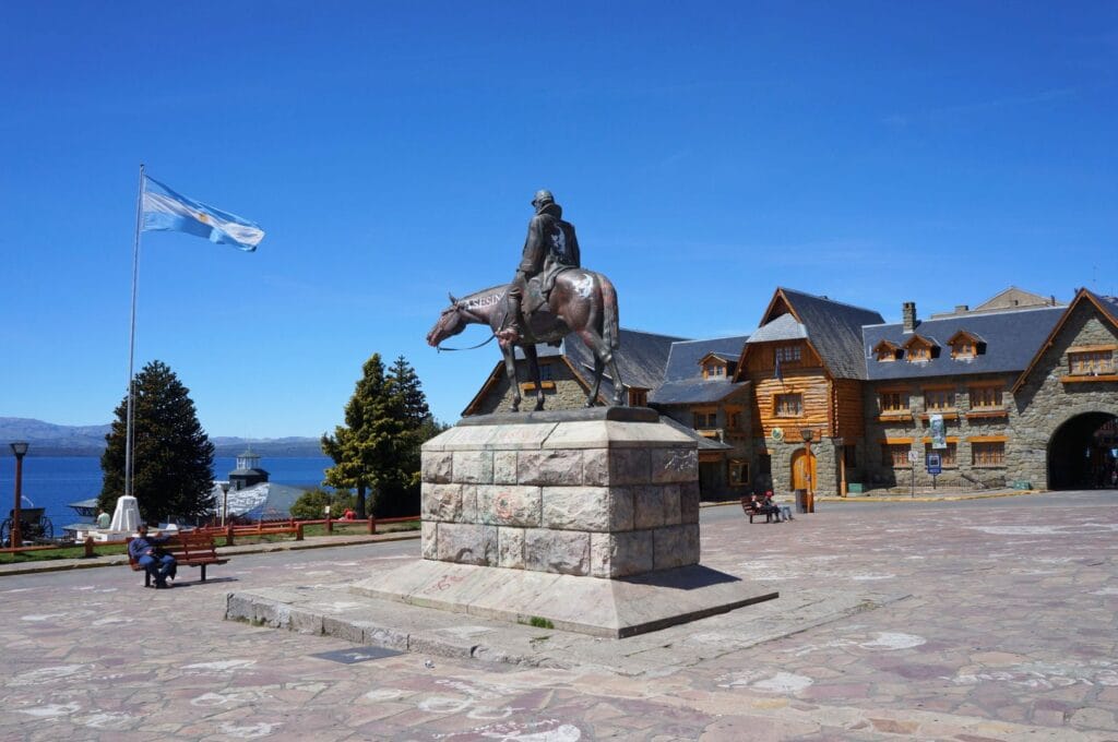
To be completely honest, we found the city of Bariloche itself rather ugly. The wooden houses, the cheesy Tyrolean music playing on every street corner, the Saint Bernards lounging in front of monuments waiting to be photographed with tourists – it’s all a bit much… But you don’t come to Bariloche to hang out with Beethoven or for the fake-traditional atmosphere. Hell no!
Personally, having a coffee on a terrace with a nice piece of chocolate in the morning, going hiking during the day, enjoying a good craft beer at sunset, then eating a succulent steak with a nice Argentinian wine – I could never get tired of that!
In this article, we offer a selection of activities and hikes you can do in a day from Bariloche. At the end, you’ll find our recommendations for finishing the day properly with a good meal or a sweet treat!
How to get to San Carlos de Bariloche
Bariloche is well-served by public transportation and has an international airport, Teniente Luis Candelaria. Even though bus journeys are long due to the size of the country, the semi-cama and cama vehicles offer excellent comfort for enduring the trip.
From Buenos Aires
Bariloche is located 1400 km from the Argentinian capital. To connect the two cities, you can choose between taking a cama bus or flying. By land, the journey is slow – taking 22 hours (but in a very comfortable bus ;)) and costs around 140 euros. Several departures are scheduled daily. By air, flights cost about 50 euros per person.
From Puerto Varas
If you’ve explored Puerto Varas and Vicente Pérez Rosales National Park, the logical next step in your itinerary should take you to Bariloche! The 300 km journey is very manageable by bus! The trip takes about 6 hours for an average fare of 40 euros. Check departure times here.
This article contains affiliate links to partner sites. When you use our links to book accommodation, a car, or an activity, you don’t pay anything extra, but we get a small commission. This helps us to offer you free, independent, and ad-free content. Thank you for your support!
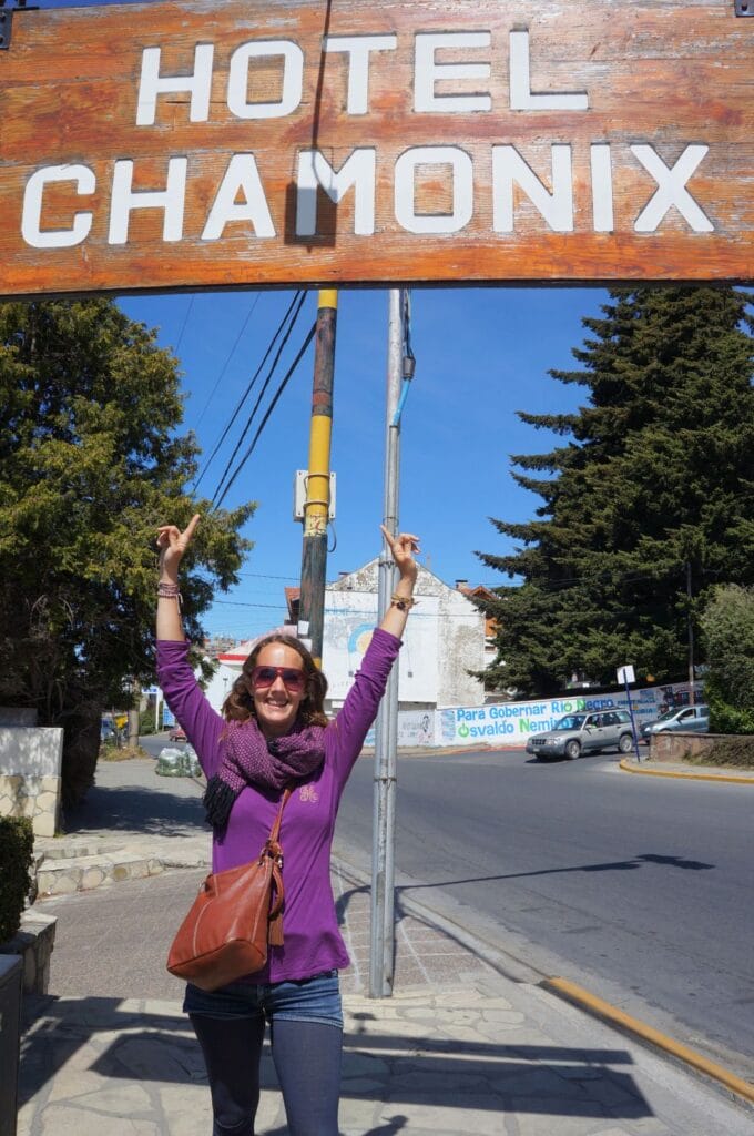
Where to stay in Bariloche
As we mentioned earlier, Bariloche’s vibe isn’t exactly exciting. So we preferred to stay slightly outside the city center, and we don’t regret it at all! We stayed for almost 10 days at Alaska Patagonia Hostel, located 7.5 km from downtown. The rates are more than reasonable for the quality of this youth hostel: about 20 euros per person in a dormitory, and 75 euros for a double room with a private bathroom. Prices include an excellent breakfast. The hostel is super nice, the staff is great, and the location is ideal for hiking. In short, we highly recommend it!
How to get around Bariloche
In this article, we talk about hikes and things to do using public transportation. In fact, we chose to see everything by bus, and it works just fine if you organize a bit according to the schedules. To travel by bus, you’ll need to buy a SUBE card from kiosks or at the SUBE office in the civic center of Bariloche on Plaza de la Libertad (the main square next to the Patagonia Museum). Per trip, depending on the distance, the fare ranges between 1 and 6 euros per person.
Nevertheless, we met many travelers who preferred to rent a car for more flexibility and to drive on the sublime roads around Bariloche, especially the Seven Lakes Road. If you want to visit several spots on the same day, it’s probably easier. To lower the price, don’t hesitate to team up with other travelers. For a rental car in Bariloche, expect to pay about 50 euros per day depending on the season and duration of the rental.
Last option: taking a taxi. It’s more expensive than taking the bus (and than renting a car over time), but it can do the job when you don’t have much choice! The rates remain accessible: a 5 km ride costs about 3-4 euros.
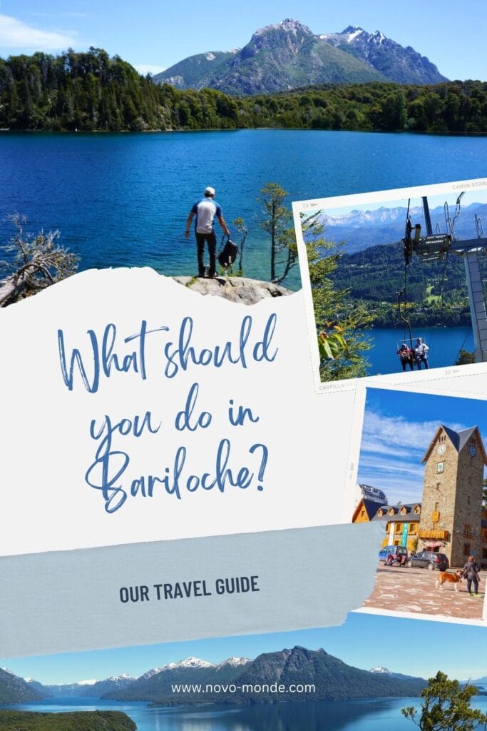
What to do and see?
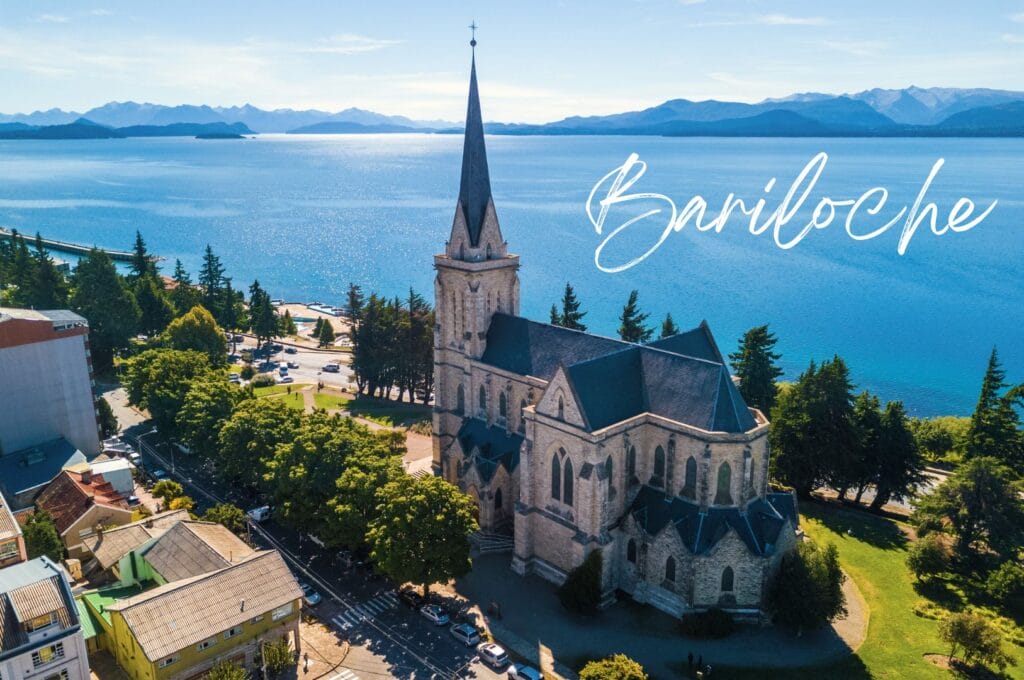
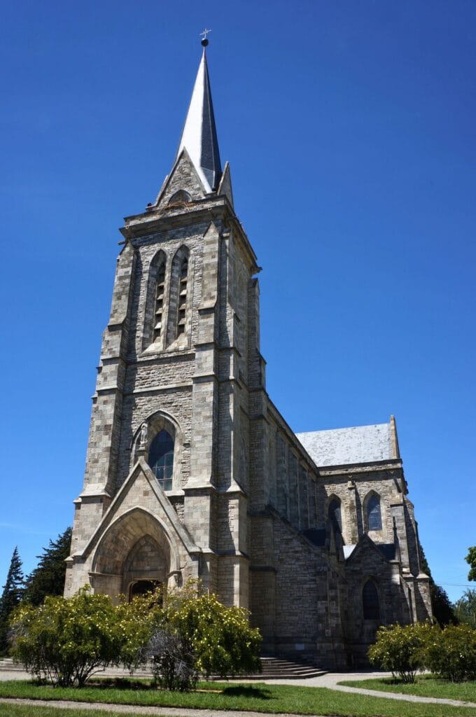
Stroll through the city
Touring the center of Bariloche can be done fairly quickly. Allow half a day in the city to focus on the surroundings ;). However, if you want to learn more about the city’s history, go beyond the very touristy side, and discover its German past, Diego will take you on a guided walking tour of the city. Another nice cultural visit is the Patagonia Museum, which focuses on the history of this large South American region, as well as its fauna, flora, and indigenous populations. Open Monday through Friday, it’s located on the main square and entry costs 3000 pesos per person.
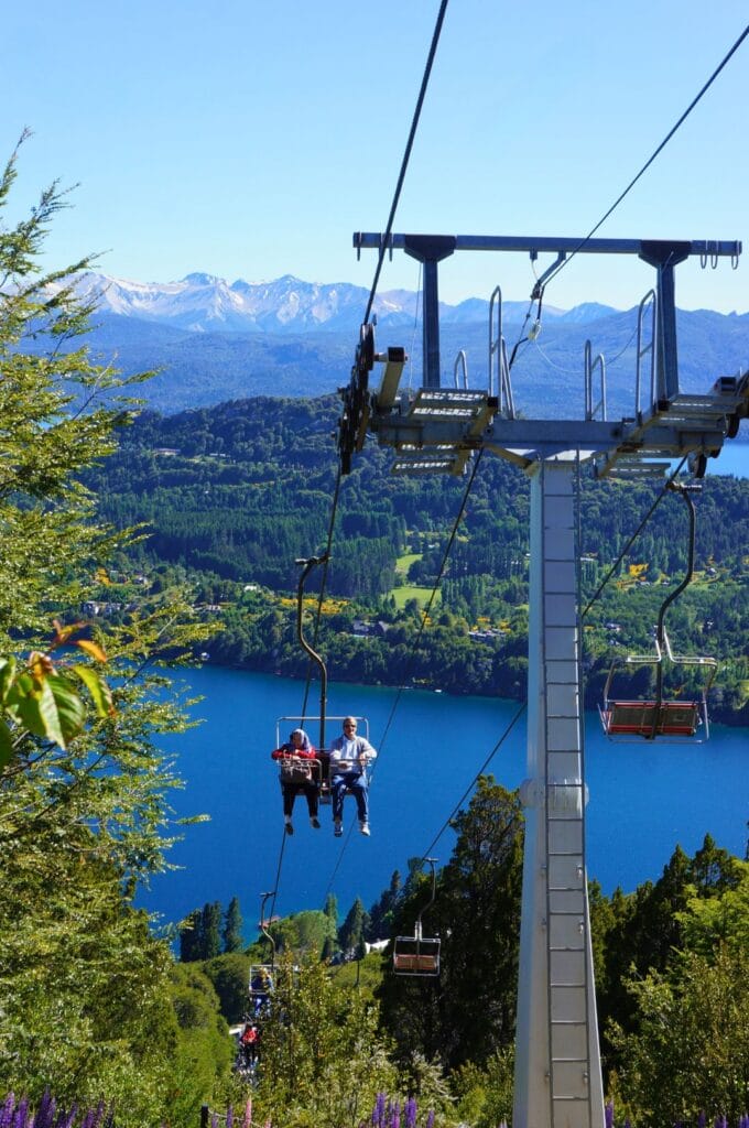
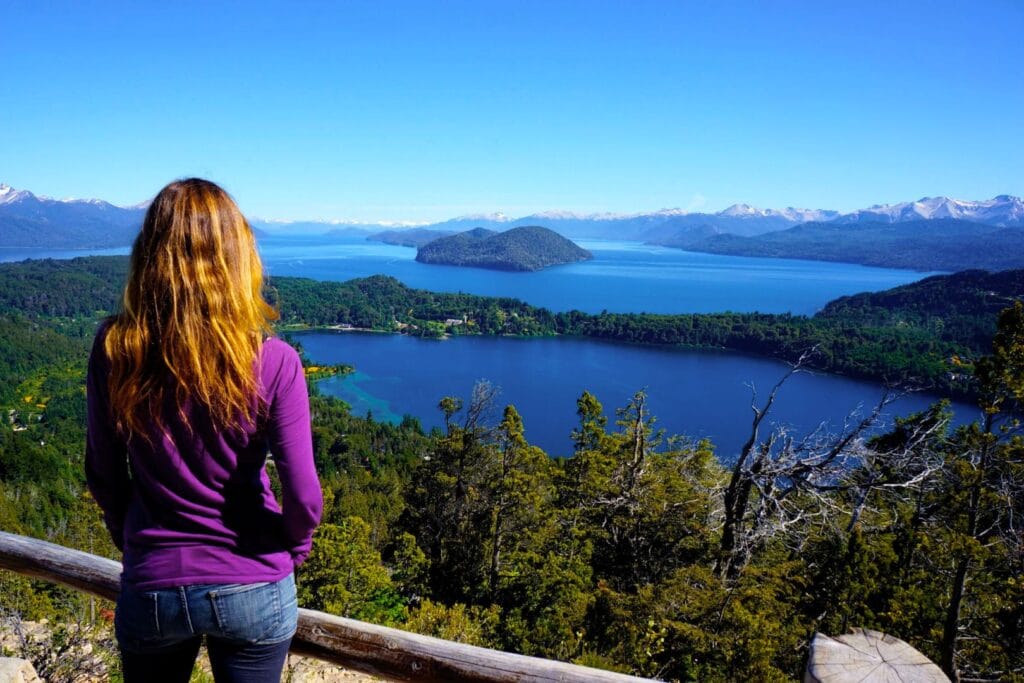
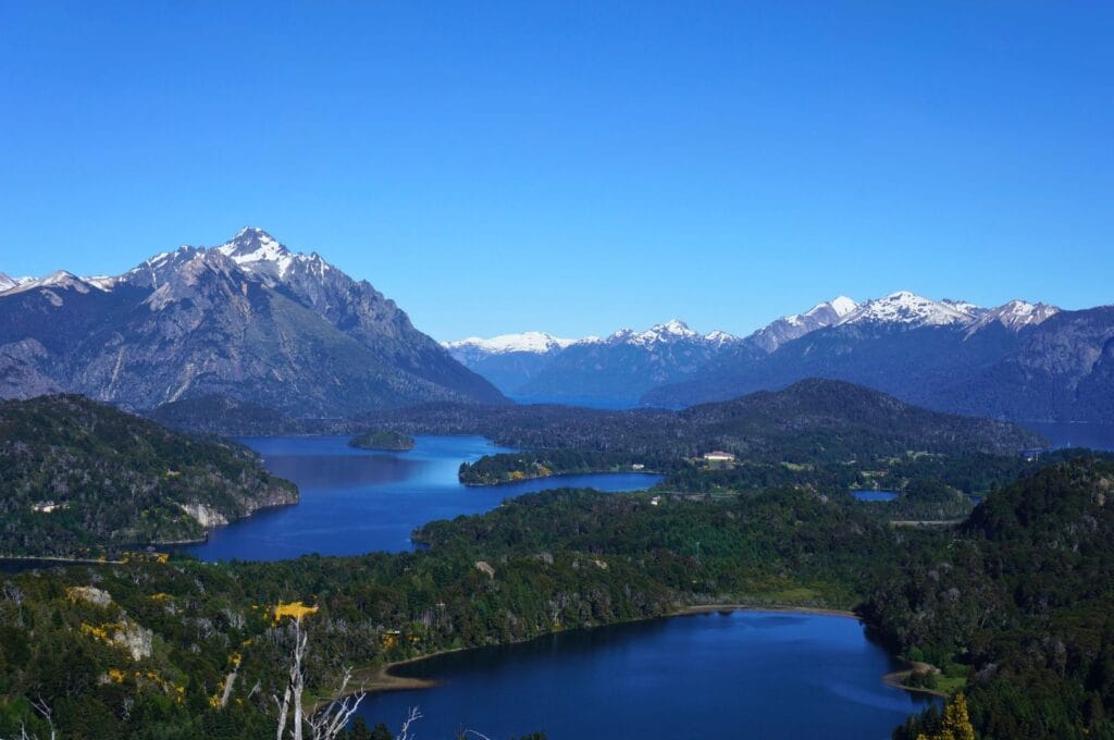
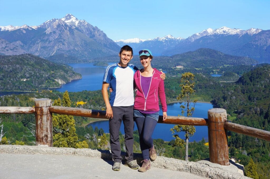
Hike to Cerro Campanario
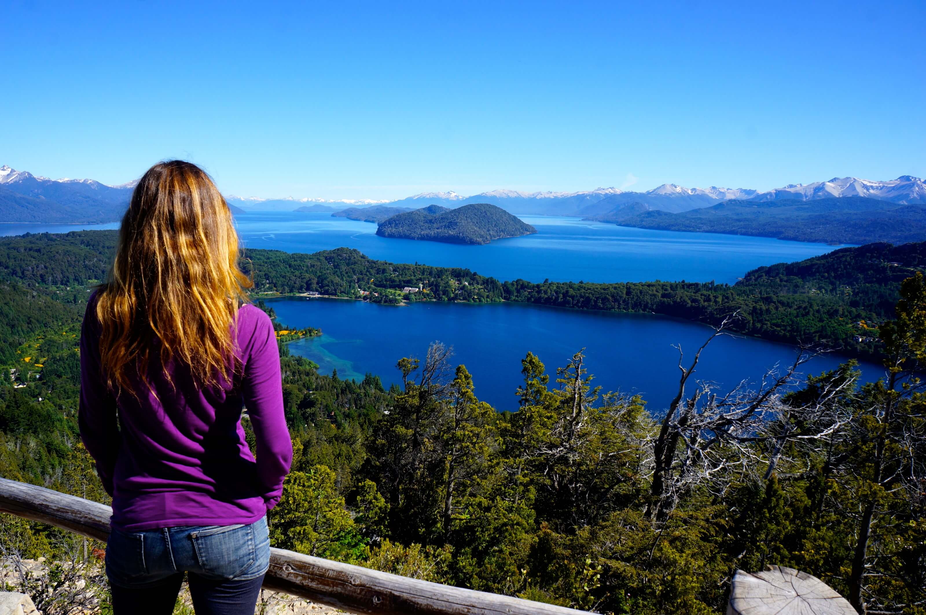
For a first glimpse of Bariloche’s surroundings, nothing beats the panoramic view from Cerro Campanario. There are several cerros in the vicinity of the city, but Campanario definitely offers the best effort-to-reward ratio in our opinion!
Located 18 km from downtown, you can reach its base by public bus (more practical info below). Once at the foot, you have 2 options: ride up in 7 minutes by chairlift for the hefty sum of 15 euros (15,000 pesos) per person, or hike up for 20-35 minutes! Knowing that for the same price, you can already treat yourself with a good glass of red wine, you can guess which option we chose! The climb is a bit steep, but if you’re used to hiking, it shouldn’t take you more than 25 minutes.
Once at the top, the view is simply splendid – a 360-degree panorama of the region’s lakes and peaks!
- How to get there: Take bus number 20 toward Llao-Llao and get off at the kilometer 18 stop (approximately 30 minutes from downtown Bariloche). Check the schedule here.
- Chairlift: 15 euros per person for a round trip.
- On foot: free, allow between 25 minutes and 1 hour for the ascent (4.6 km round trip, 216 m elevation gain, easy/intermediate).
Tip: Go early in the morning, around 8:30-9:00 am, or late in the day for sunset. At these times, there aren’t many people! From 10 a.m., tourist buses start arriving, and it quickly becomes crowded at the top, especially during high season!
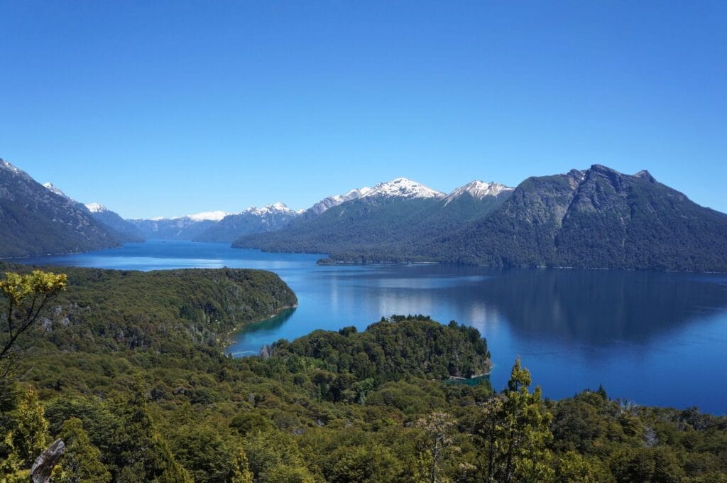
Do the Llao-Llao Loop
A very nice walk that’s not necessarily well-known around Bariloche is the loop in Llao-Llao Municipal Park. After warming up our calves climbing Cerro Campanario, we couldn’t possibly stop for the day. So we took the bus to the terminus to discover this little trail on the Llao Llao peninsula. A lovely walk of about 17 km that can easily be done in 6 hours with plenty of beautiful viewpoints over Lakes Nahuel Huapi and Moreno, Cerro Capilla… Yes, we take our time for nice photos and to have a snack waterfront… Well, we avoid putting our feet in the icy water, but you get the idea!
- How to get there: Still with bus 20, get off at the Llao stop, at kilometer 25 (45 minutes from downtown Bariloche). If you’re short on time, a guided tour might be a solution!
- The hike: 16.6 km, 5 hours, 630 m elevation gain, easy.
Bike the Circuito Chico
The Circuito Chico is a 65-kilometer scenic route that people mainly travel by bike! In fact, it extends the Llao-Llao loop described just above. If you don’t feel like biking, you can do it on foot, by bus (line 20), by car, or with an organized tour. From Bariloche, this route takes you along Lago Nahuel Huapi to make a loop on Road 77. Here’s the map with all points of interest.
You’ll find many specialized shops offering bike rentals. Expect to pay around 30 euros per person for a mountain bike and 60 euros for an electric bike per day. Also, the loop starts in Bariloche, but you can shorten it by starting further west, at the roundabout just before Villa Campanario, where you’ll find the Circuito Chico Adventure rental shop. This gives you a 25-kilometer route.
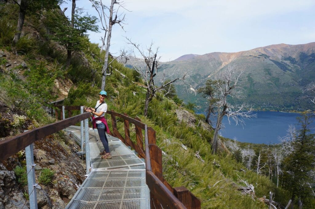
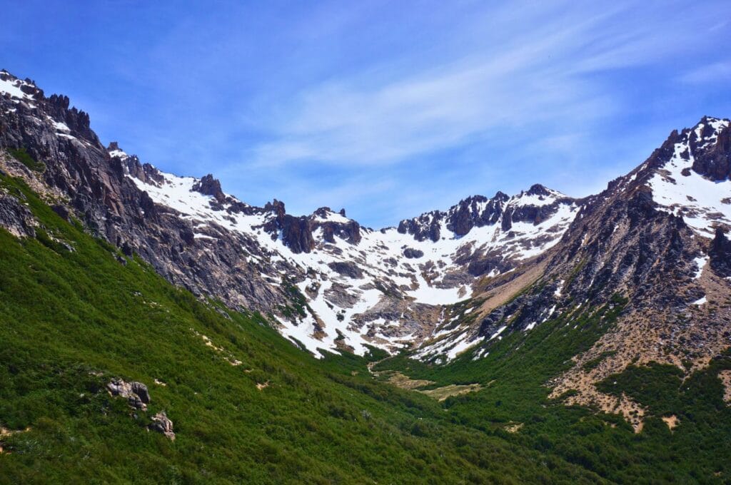
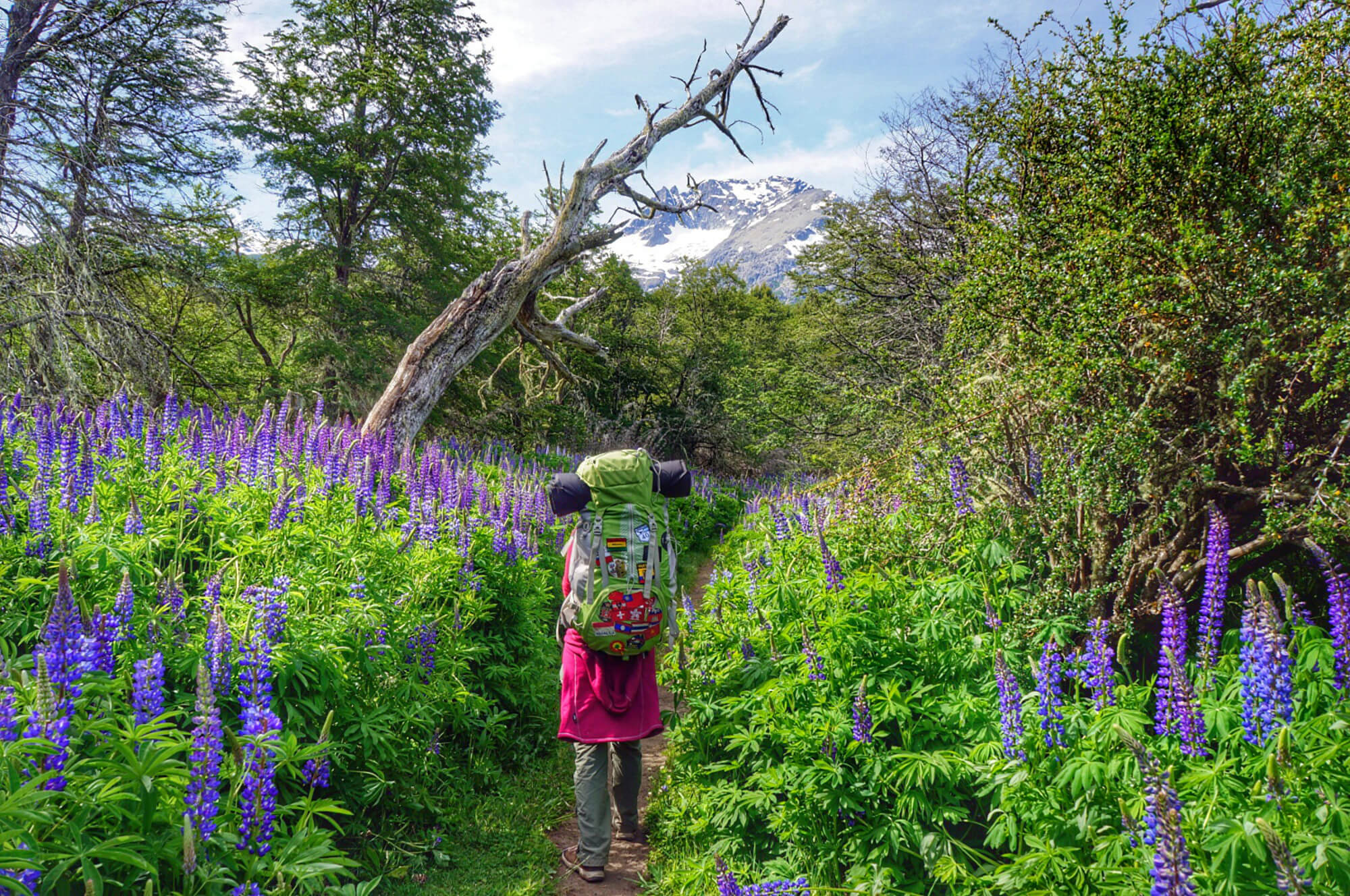
Trek across Nahuel Huapi Park
Originally, we wanted to do a 4-day trek, the Traversia 4 refugios. But as was the case during our visit to Pucón in Chile a few weeks ago, we were still a bit too early in the season. The hiking trails were still closed due to snow… 🙁 So note to enthusiasts: to do the traverse, you must wait at least until mid-December, and in some years even until January or February! To know the status of trails in this area, a visit to the national park office is essential :).
If this trek interests you, here’s a summary of this long hike and the GPS track to download. You can do it in 5 days and 4 nights or 4 days and 3 nights (the last 2 days can be combined). The tricky part is mainly the section between the Jakob Refuge and the Laguna Negra Refuge: the path is not marked, and some passages are technical (exposed sections, climbing…). In fact, once at the Jakob Refuge, you have to fill out a questionnaire about your trekking equipment and mountain knowledge to see if you’re fit to continue the trek…
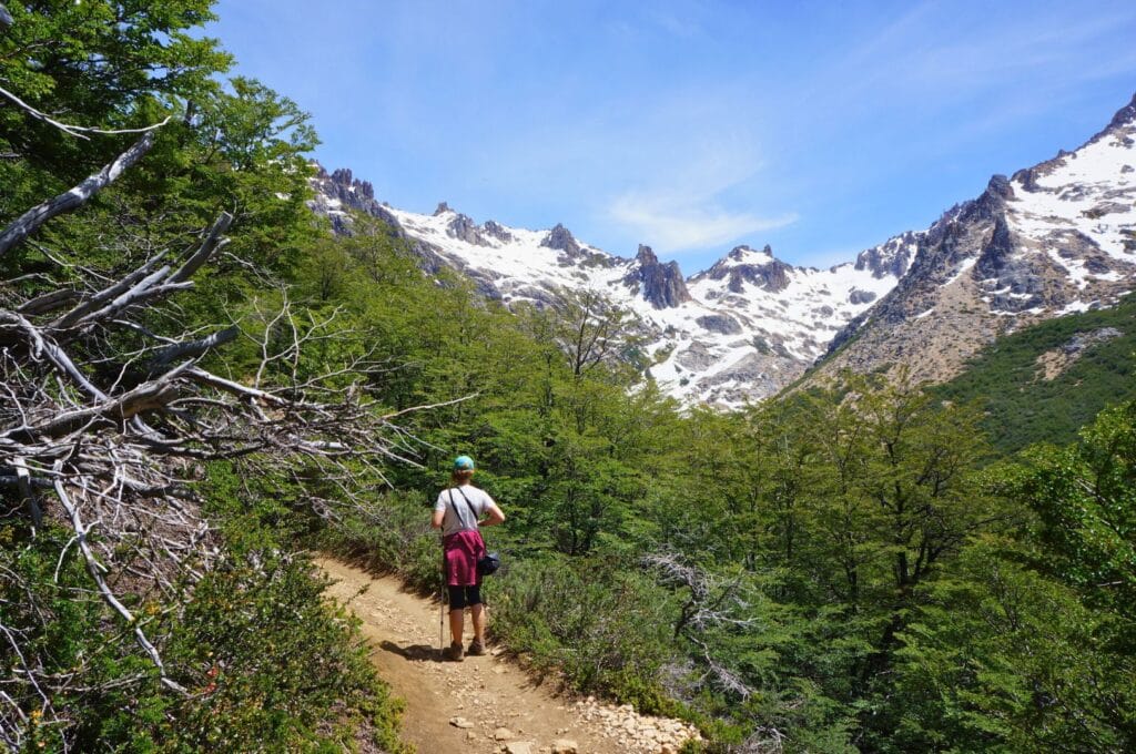
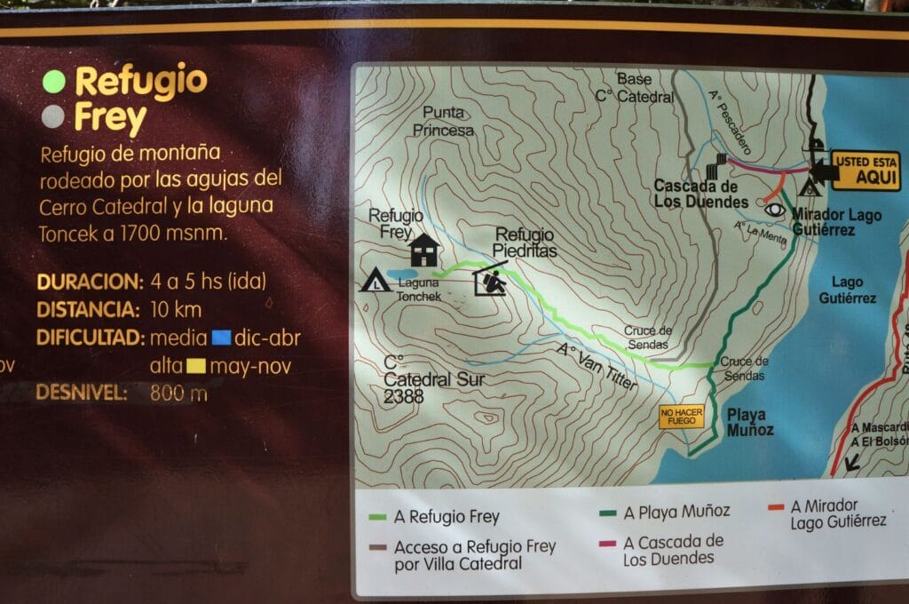
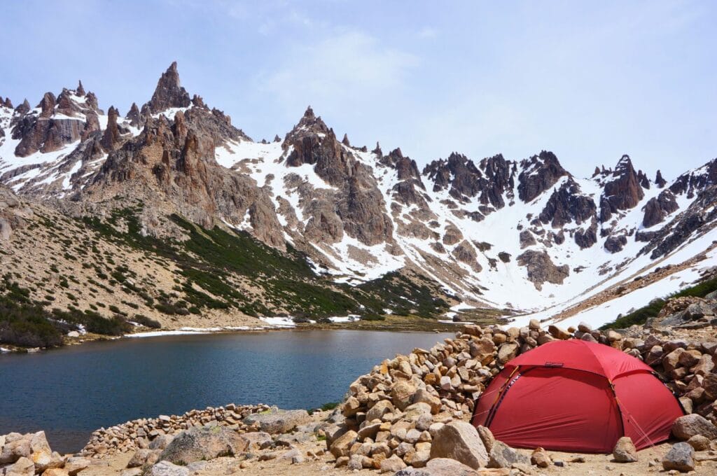
Climb to Refugio Frey, paradise for climbers
The hike
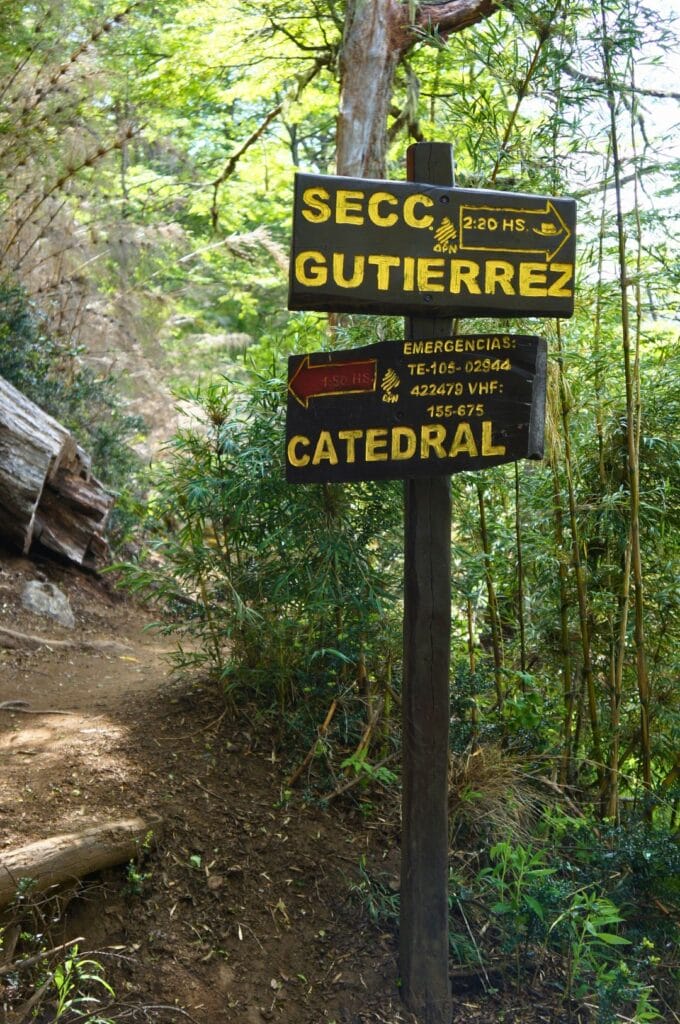
Due to these conditions, we decided to opt for a day hike to Refugio Frey. This is actually the first section if you do the entire park traverse.
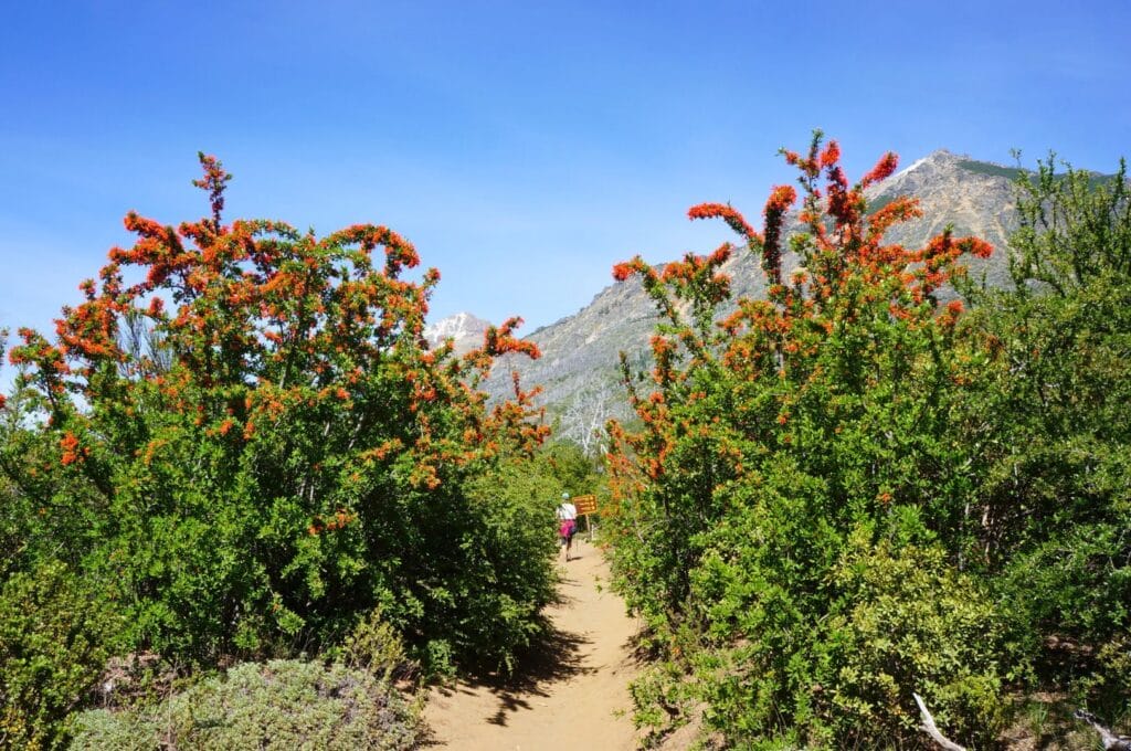
The hike starts in two places (all info below), and we decided to start from the Villa Los Coihues village. After getting off the bus, you first have to walk along Lake Gutiérrez for 2.5 km on a dirt road to reach Lago Gutiérrez campground. This is where the actual entrance to Nahuel Huapi National Park is located.
Once in the park, the hiking trail is very well-marked, and the path is extremely well-maintained! The first kilometers are all flat and follow the lake before tackling a first climb through a forest that unfortunately burned a few years ago. The charred trees give a strange atmosphere to the place…
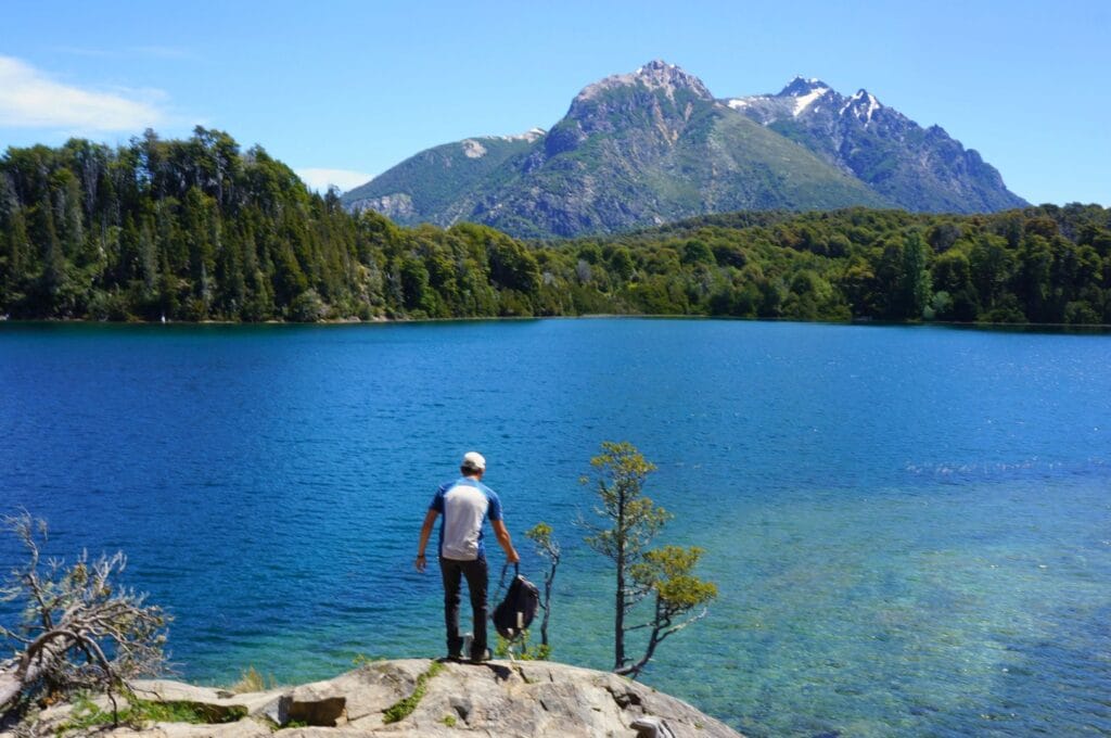
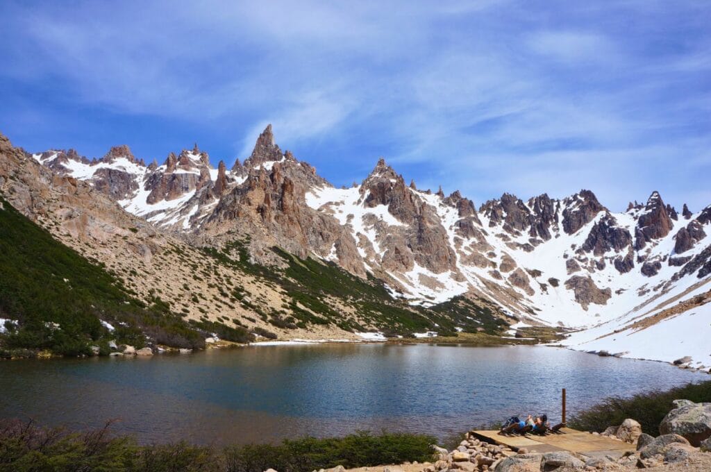
Arrival at Refugio Frey
After 2 good hours of climbing, we gently but surely start to pass the tree line. You can see the landscape changing. Trees and yellow flowers give way to rock and snow! After one final push on a last steep section, we reach Refugio Frey, nestled on the edge of Laguna Toncek and surrounded by Cerros Catedral Sur and Norte.
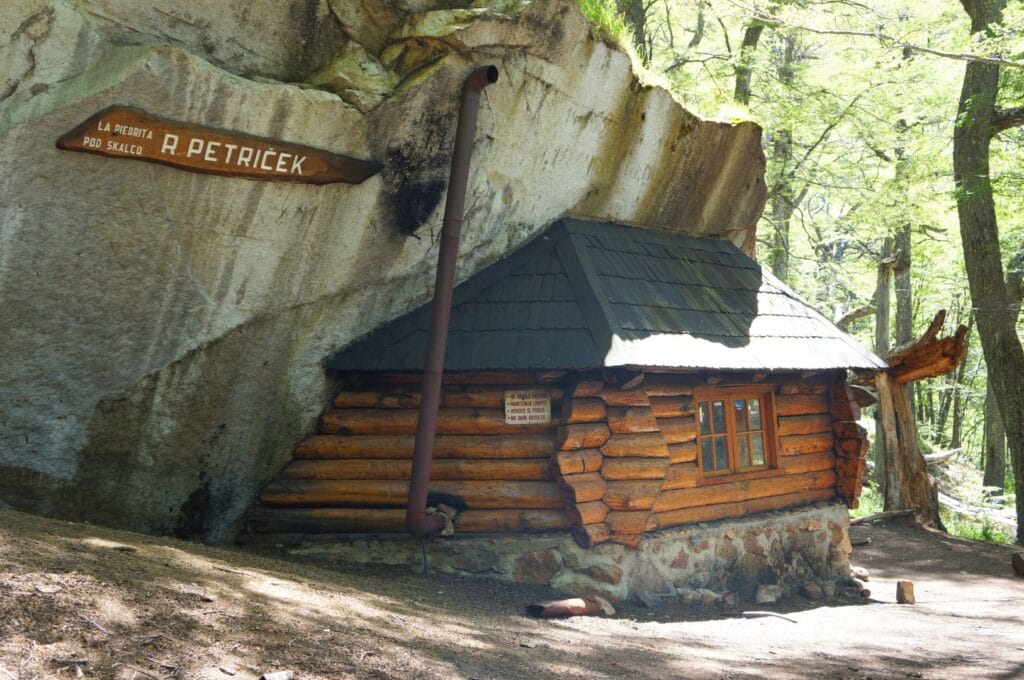
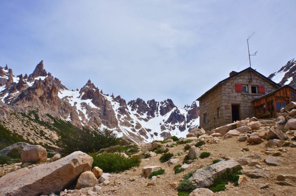
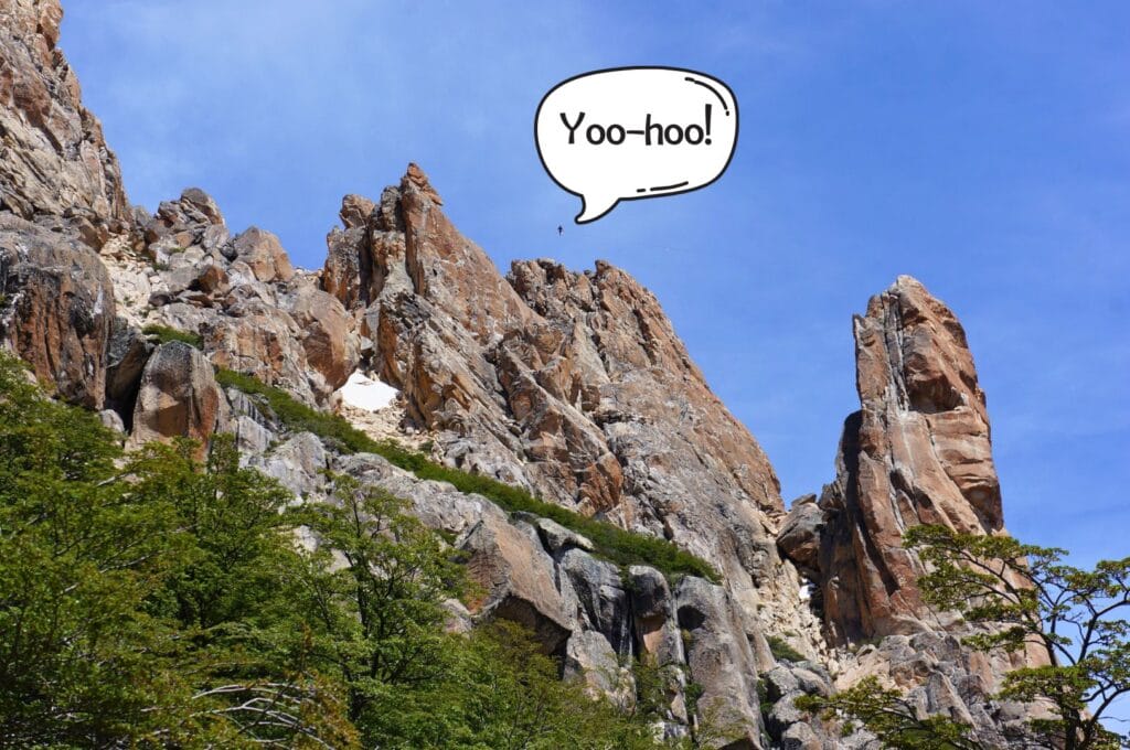
Refugio Frey is also the meeting place for many climbers from around the world. They come together to challenge the different peaks and try various walls for all levels. In fact, on the day we visited, two guys had even had fun setting up a slackline between two of these peaks! Crazy if you ask me as someone scared of heights. Seriously? Walking on a wire at least 50 m above ground with crazy wind blowing, that’s madness! (Don’t worry, they were secured!)
The descent to Villa Catedral ski resort
For the return, we opted for the classic route, i.e., the path that leads to the Villa Catedral ski resort, a major winter sports destination on the slopes of Cerro Catedral! This alternative path not only offers the advantage of varying the scenery a bit and enjoying a plunging view of Lake Gutiérrez but also limiting the negative elevation on the return!
- Distance: about 19 km if you start from Villa Catedral, the classic route, and about 22 km if you start as we did from Villa Los Coihues. To enjoy the place more, you can spend the night at the refuge! If you’re hungry or thirsty, you’ll find refreshments for hikers at Refuge Frey.
- Duration: Allow between 3:30 and 5 hours for the ascent from Lake Gutiérrez and about 2:30-3 hours for the descent to the foot of Cerro Catedral.
- Positive elevation gain: 860 m for the classic route (or 1300 m)
- Negative elevation: 860 m (or 1100 m)
- Hike difficulty: easy/intermediate
- To get to the start of the hike: either start at Villa Catedral (take bus 55 and get off at the terminus at Catedral, 45 minutes journey), or start as we did at Villa Los Coihues (it’s line 50, get off just after the bridge, 35 minutes journey from downtown). Check the schedules for all bus lines.
- To return from Villa Catedral: line 55 connects the Catedral ski resort to downtown Bariloche with departures every 2 hours: 2:10 p.m., 4:10 p.m., and the last bus is at 8:10 p.m.
- Topo map of the hike to download on AllTrails
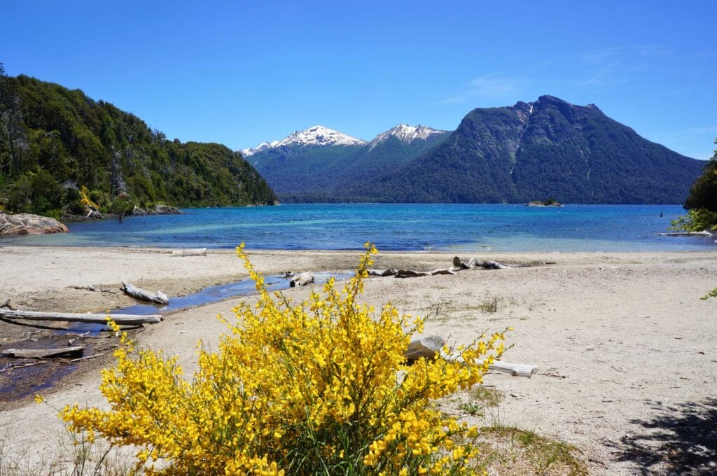
Do the Route of the Seven Lakes in one day
The Seven Lakes Road is a scenic drive on the famous Ruta 40, to be done by car from Bariloche. It starts in Villa La Angostura and ends 108 km further north, in San Martín de los Andes, but you can definitely do it in the other direction. Since we didn’t rent a vehicle, we didn’t do this circuit… But maybe we should have. Indeed, the landscapes are simply sublime with these 7 crystal-clear lakes (in truth, there are more than 7 lakes to discover ;)) and the mountains in the background! And in terms of activities, there’s plenty to do with hikes, kayaking, boating…
The itinerary
Here are the main stops on this road trip on the Ruta de los Siete Lagos:
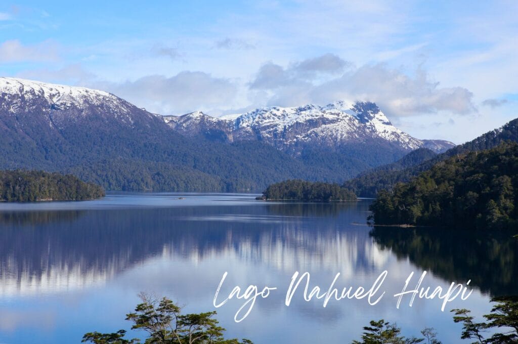
- Lake Nahuel Huapi: in Villa La Angostura, stop at Los Arrayanes National Park to walk among the magnificent arrayán trees with their unique cinnamon color, some over 650 years old and reaching 15 m in height. Entry is free if you only go to the first two viewpoints on the peninsula, Brazo Norte and Bahía Mansa (3 km round trip, 200 m elevation gain, 1-1:15 h). Otherwise, the total trail to the tip is 23 km round trip!
- Lake Correntoso: a small beach is accessible just at the bridge at the exit of Villa La Angostura, before reaching the next lake. Further on, stop at the bridge spanning the Río Correntoso, supposedly the shortest river in the world at 200 meters long! After passing Espejo, other viewpoints look out over Correntoso.
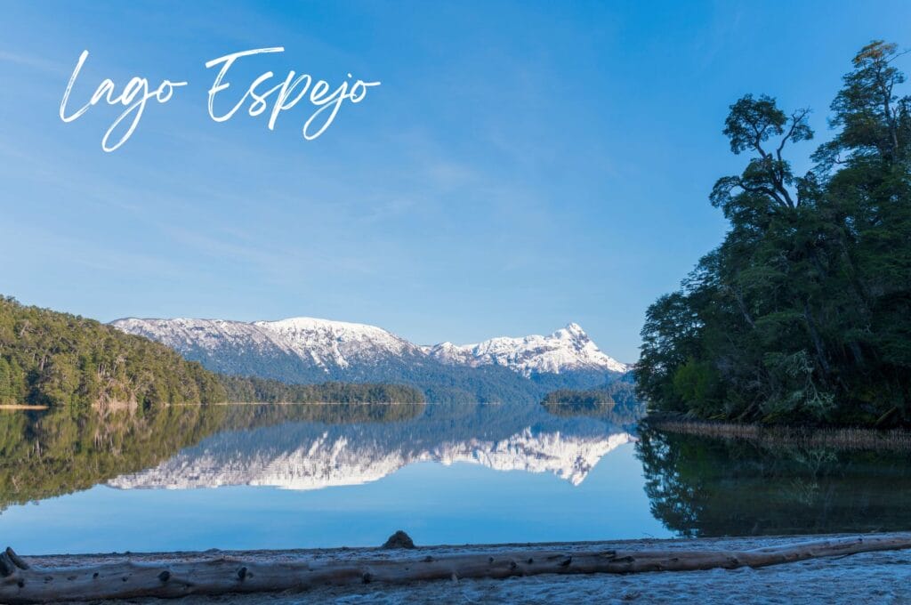
- Lake Espejo: if you have time, go to Aguada del Burro beach (2 km round trip, 100 m elevation gain) or take the trail that connects Espejo to Correntoso (2.5 km, 110 m elevation gain) for a very nice view of the shimmering waters of the lake.
- Lake Escondido: before the viewpoint overlooking this small lake, a short hike (5 km round trip, 60 m elevation gain) takes you to the edge of the Ñivinco waterfall.
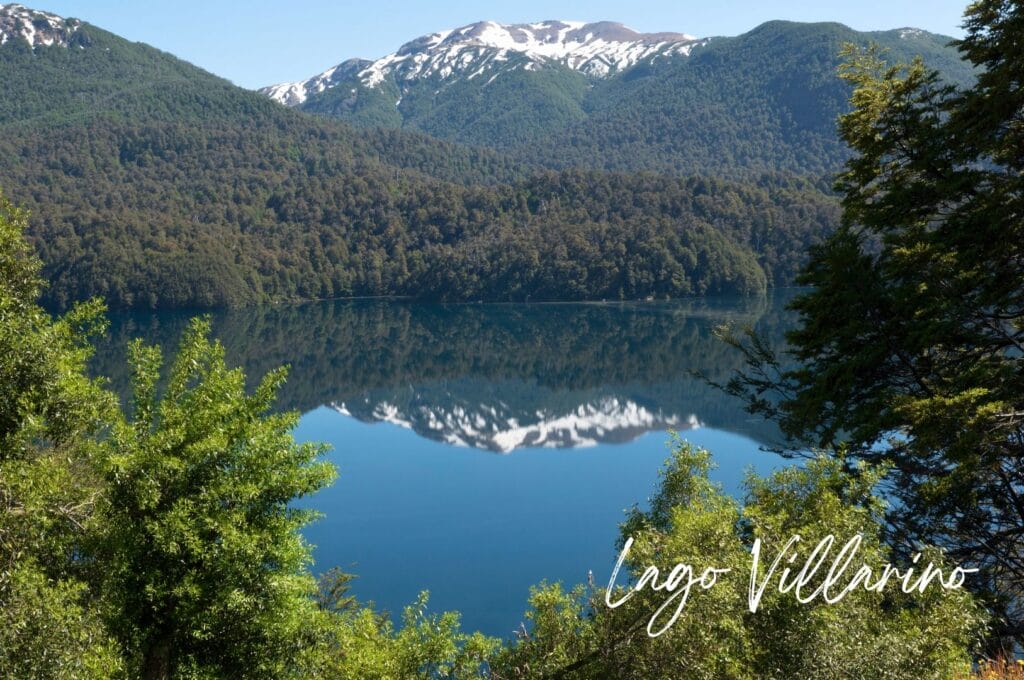
- Lakes Villarino and Falkner: if you feel like it, climb Cerro Falkner for a breathtaking panorama of the region! Though it’s quite a walk – 8 km with 1000 m elevation gain! Otherwise, a hiking trail follows the first lake for 1.7 km. Then, 1 km further on the road, you have a viewpoint giving a superb view of the Vuliñanco waterfall in a magnificent Andean environment.
- Lake Machónico and its viewpoint.
- Lake Lácar: it borders the town of San Martin de los Andes, the terminus of the Route of the Seven Lakes! To enjoy the waterfront, a 4 km trail reaches the Bandurrias viewpoint; it starts just west of the small port.
Practical information
To travel the Seven Lakes Road, the easiest option is still to rent a car, whether you start from Bariloche or San Martín de los Andes. To reduce costs, make friends with other travelers! Hitchhiking is possible since plenty of tourists do this road trip. But it might take more time… Some also cycle it in slow mode. To our knowledge, there’s no specific bus that would stop at the different stages. However, some guided tours take you for the day on this mythical road of Argentinian Patagonia!
Hike around Pampa Linda
After the Llao Llao loop and Refugio Frey, we went further from Bariloche to go deeper into Nahuel Huapi Park and the Andes mountains. We spent 4 days in Pampa Linda to get a closer look at the Tronador volcano and explore the surroundings!
Learn Spanish
When traveling in South America, it’s always better to know a few words of Spanish! When we arrived on the South American continent, we decided to take Spanish lessons in Quito. To be completely honest, Bariloche (and Argentina in general) is probably not the cheapest place to learn Spanish. For lower rates, you’ll need to look to Ecuador, Bolivia, or Peru. That said, it’s still quite reasonable compared to course rates back home. In Argentina, you generally have to count about 11 euros per hour. But whatever the case, Bariloche is a really nice city in terms of activities!
Where to eat in Bariloche: our recommendations
Eat a good piece of meat
For this, only one address: El Boliche de Alberto! They have 3 locations downtown, including 1 that specializes in pasta (don’t go to that one!). On the menu at the other 2? Meat, of course! And what meat! Honestly, we ate one of the best steaks of our lives! The prices aren’t cheap, but given the size of the portions, you can easily share between 2 people.
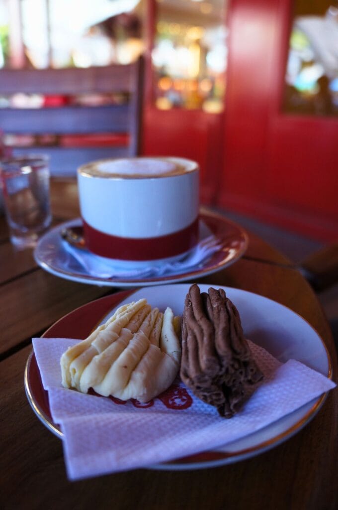
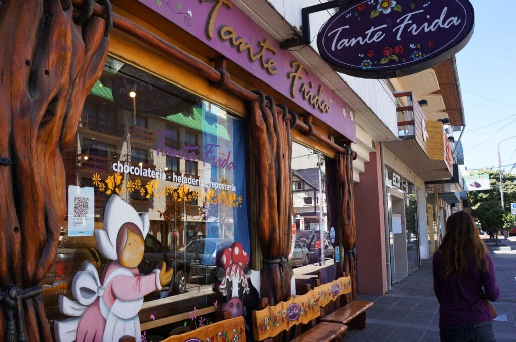
Enjoy good chocolate
The best address (but also the most expensive) for eating chocolate in Bariloche is Rapa Nui. No, we’re not talking about the other name for Easter Island but the shop located on Mitre Street, the main street that starts from Plaza de la Libertad. But don’t worry, the downtown streets are full of alternative chocolate shops that are less expensive and (almost) as good.
Bariloche’s specialty is chocolate en rama, a kind of chocolate branch in thin layers that melts in your mouth. Mmmmm, believe me, it’s the best way to forget your post-hiking muscle aches!
There you have it – you now know everything about San Carlos de Bariloche! Will this Little Switzerland of Argentina be part of your itinerary?
You’ve probably noticed that our program consists of numerous hikes?! Well, we’re continuing on this path and taking you for 4 days to Pampa Linda, to meet the Cerro Tronador volcano! No doubt, it will be good training before starting a trek in Torres del Paine National Park!
Pin it
Join the discussion