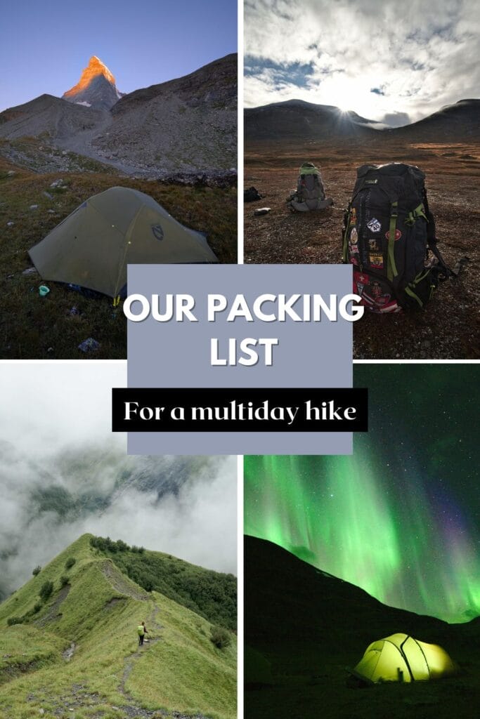

Our brand new guide and ebook on the Swiss Via Alpina has just been released! A digital book that contains everything you need to know to prepare this beautiful 380 km trek through the Swiss Alps.

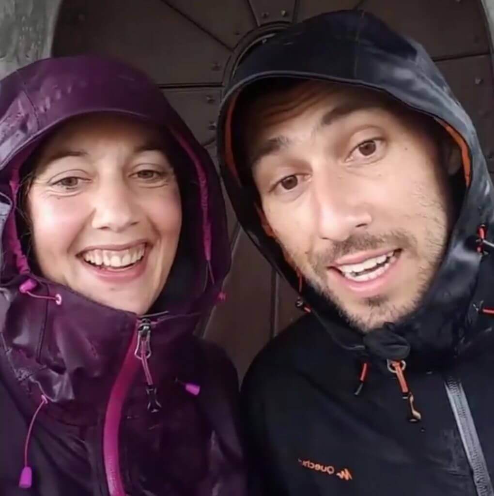
Are you looking for an idea for a long hike in Switzerland? Then don't move, you're in exactly the right place! :) In the summer of 2017, Benoit and I decided to go hiking in our own country and cross Switzerland via the Alps.
On this page we have decided to gather all the practical information we would have liked to have had before our departure from Sargans but we also share with you our best photos of this magnificent trek in Switzerland!
In all we wrote 8 very detailed blog about our crossing of Switzerland on foot. You will find them all at the bottom of this page.
Update 2020: After receiving many questions about our itinerary, equipment and logistics we have decided to publish an ebook with all the information you might need to prepare your trek in Switzerland. More information on this ebook
If you prefer to have our ebook in epub format (for your e-readers), you can also buy it directly on Fnac/Kobo or Apple books (Then, if you want to get the GPX files of the Via Alpina, contact us by email at contact[at]novo-monde.com with your order confirmation).
Here is the map of our adventures on the via alpina. At the end of this page you will find all the articles we have written about this great adventure but if you prefer to get an idea on a map we have placed our different articles on the map of Switzerland below... The big advantage of the Via Alpina Suisse is that it is of course possible to do it all like we did, but it is also perfectly possible to cover only a few sections at a time (we share with you our 2 "favorite" sections which can be easily done over an extended weekend at the end of this page)
See the map below:
Before I tell you more about the Via Alpina I let you take a look at the short video we made after our hike... 23 days of walking, and full of great memories!
Do you want to see more videos? We invite you to discover our daily Vlogs on our Youtube channel... The videos are more "shaky" (sometimes we went through serious S***!) and in a much more "live" spirit. --> Over here.
PS: Don't forget to subscribe to our Youtube channel! It will allow you to see our latest videos but also to show us that you appreciate our work:)
At the level of the season there is to be honest very little suspense.... Since this hike passes through relatively high alpine passes, it is necessary on the one hand to wait until the snow of the previous winter has melted well (generally from mid-July it is good) and on the other hand to be careful not to be surprised by the first snows of the following season (end of September depending on the year).
 After that it is obvious that it varies from year to year, but overall August and September are the safest months in terms of climate to embark on a hike like this.
In terms of the weather itself, it is always difficult to make predictions for such a long period of time.... And let's be honest, if you leave for 3 weeks you will almost certainly have a few bad days;)
For our part, we were pretty lucky. We left under the sun, the weather quickly deteriorated and we suffered 4 quite catastrophic days (understand by this that it was raining almost non-stop and that despite a good equipment we were simply soaked permanently). But after these few very bad days, mother nature probably decided that she had made us suffer enough and the next 15 days we had a great weather! In short, it's a bit of a lottery, but overall in August-September the weather is ideal.
The "international" via alpina crosses Switzerland (green route) but it is made in such a way that it can be continued afterwards. During our hike we chose the "100% Swiss" version which crosses Switzerland from east to west, from Vaduz to Montreux.
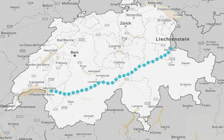
Of course it is possible to do this itinerary in both directions, but for our part we opted for this direction because it allowed us to finish at Le Rocher-de-Naye and its incredible panorama on Lake Geneva.
Lake Geneva is where we grew up, the place we call home... so it was a great bonus to be able to "go home" on foot (and be welcomed on arrival by our best friends who were waiting for us with an aperitif) ;)
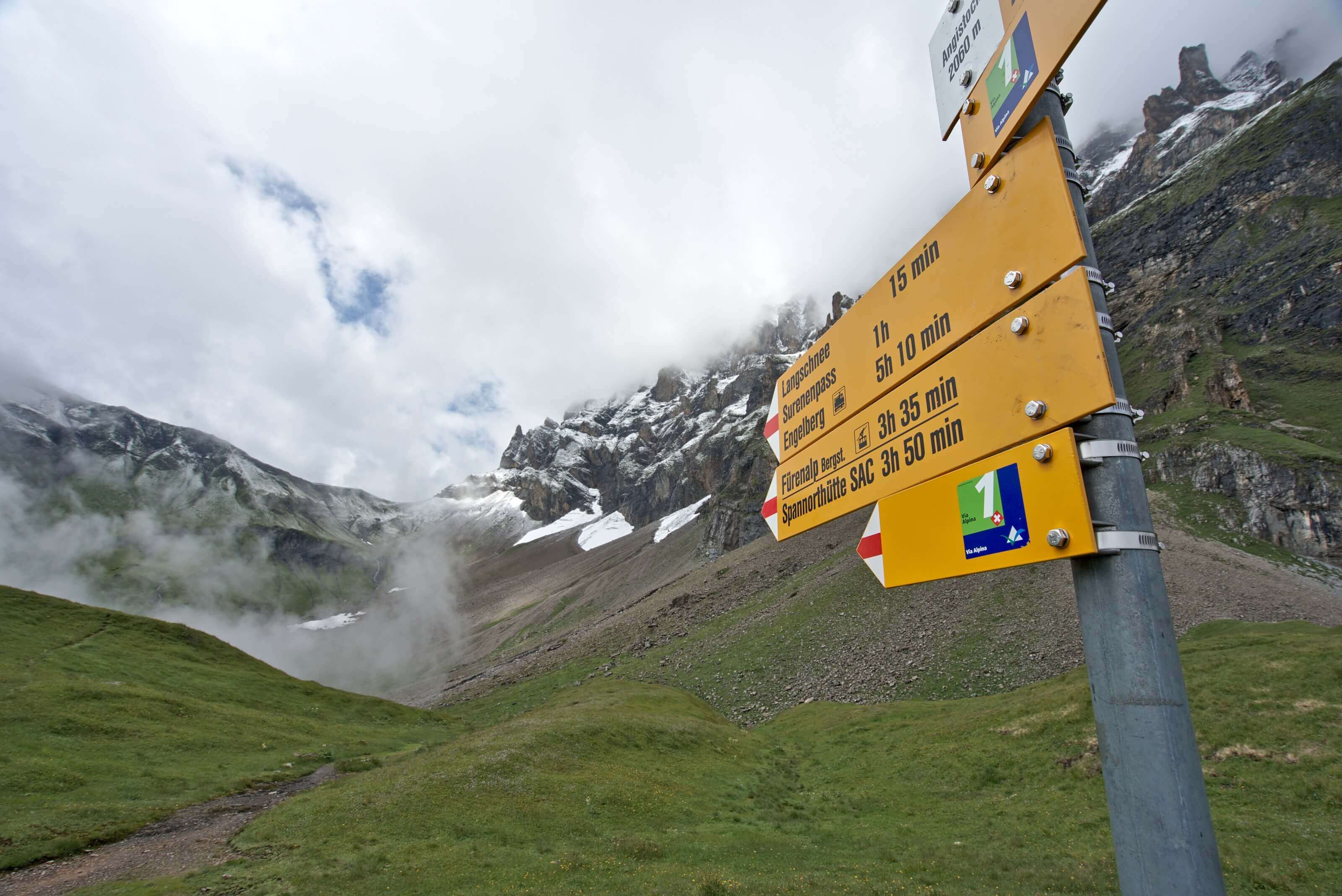
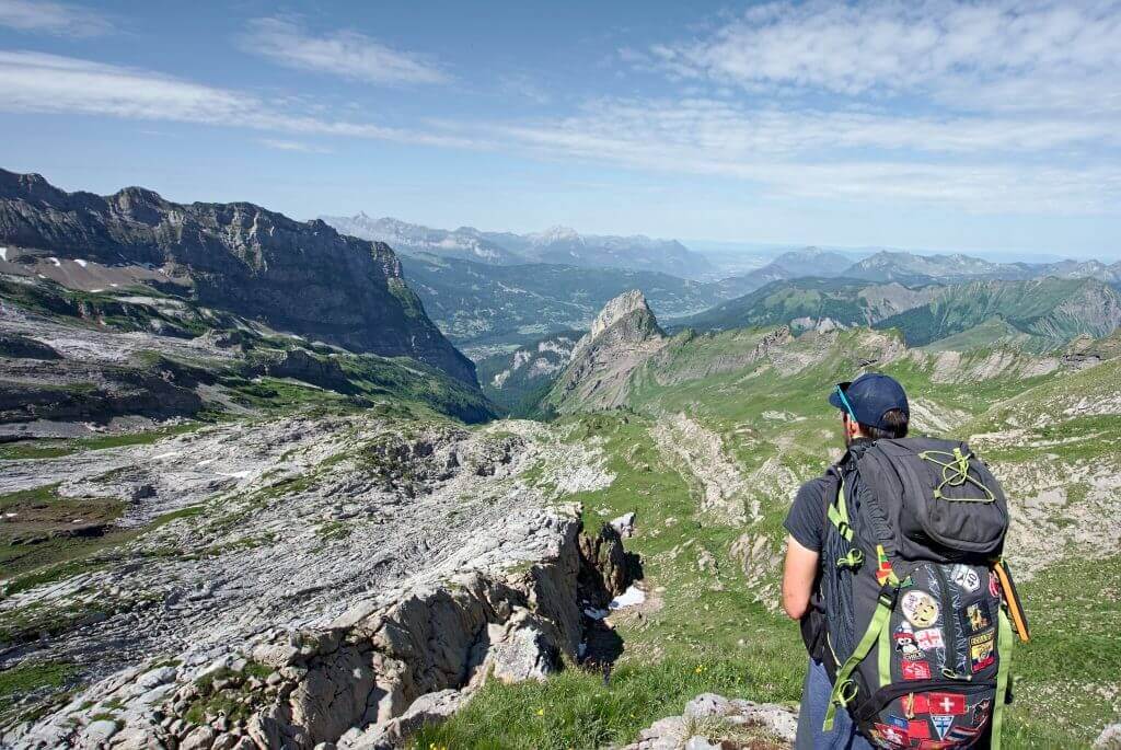
 At the level of the route this Swiss Via Alpina is well-marked by small signs bearing the number 1. Promise you won't have any difficulty in finding your way around: the signs are really EVERYWHERE in Switzerland!
Below you will find the stages, and "official" distances. The official stages are made in such a way that the entire route can be done without a tent by sleeping every night in inns, mountain huts or cottages.
| Stage | distance | Elevation change |
|---|---|---|
| Vaduz - Sarganz | 27km | 540m+ / 1650m - |
| Sarganz - Weisstannen | 13km | 800m + / 280m - |
| Weisstannen - Elm | 23km | 1400m + / 1450m - |
| Elm - Linthal | 24km | 1650m+ / 2000m - |
| Linthal - Urner Boden | 16km | 110mm + / 400 m - |
| Urner Boden - Altdorf | 27km | 950 m + / 1850m - |
| Altdorf - Engelberg | 30km | 2100m + / 1500m - |
| Engelberg - Engstlenalp | 12km | 1300m+ / 440m - |
| Engstlenalp - Meiringen | 21km | 740m+ / 1985m - |
| Meiringen - Grindelwald | 23km | 1500m + / 1100m - |
| Grindelwald - Lauterbrunnen | 19km | 1150m + / 1400m - |
| Lauterbrunnen - Griesalp | 22km | 2000m + / 1400m - |
| Griesalp - Kandersteg | 17km | 1450m + / 1700m - |
| Kandersteg - Adelboden | 17km | 1400m + / 1250m - |
| Adelboden - Lenk | 14km | 720m + / 1000m - |
| Lenk - Gstaad | 22km | 1150m + / 1150m - |
| Gstaad - L'Etivaz | 17km | 1300m + / 1200m - |
| L'Etivaz - Rossinière | 14km | 340m + / 580m - |
| Rossinière - Rocher de Naye | 19km | 1900m + / 820 m - |
| Rocher de Naye - Montreux | 13km | 120m + / 1700m - |
Then I don't hide from you that doing it in a refuge/hotel takes away a lot of flexibility. Some steps are almost "too short" while others are (in my opinion) crazy long. In the itinerary above there are 2 stages in particular which in my opinion are really way too difficult.

We decided to do the via alpina with our tent which means that our steps were slightly different. Here is what we have done represented on a map:
You can see the map directely on AllTrails and download the route by clicking here
Note: You will notice that we had 19 stages, but in total the via alpina took us 23 days. The reason? Days off! ) vital for leg recovery and morale (especially on rainy days).
As I said before, it is quite possible to follow the Via Alpina Suisse by carrying only a small bag with clothes and some provisions. Indeed, the route passes very regularly through mountain villages / ski resorts / mountain refuges and it is quite possible to build your itinerary so you can sleep in a bed every night. Of course this option has a cost.... Housing in Switzerland is not the cheapest option and quickly costs more than CHF 50 per person on average (even in dormitories).
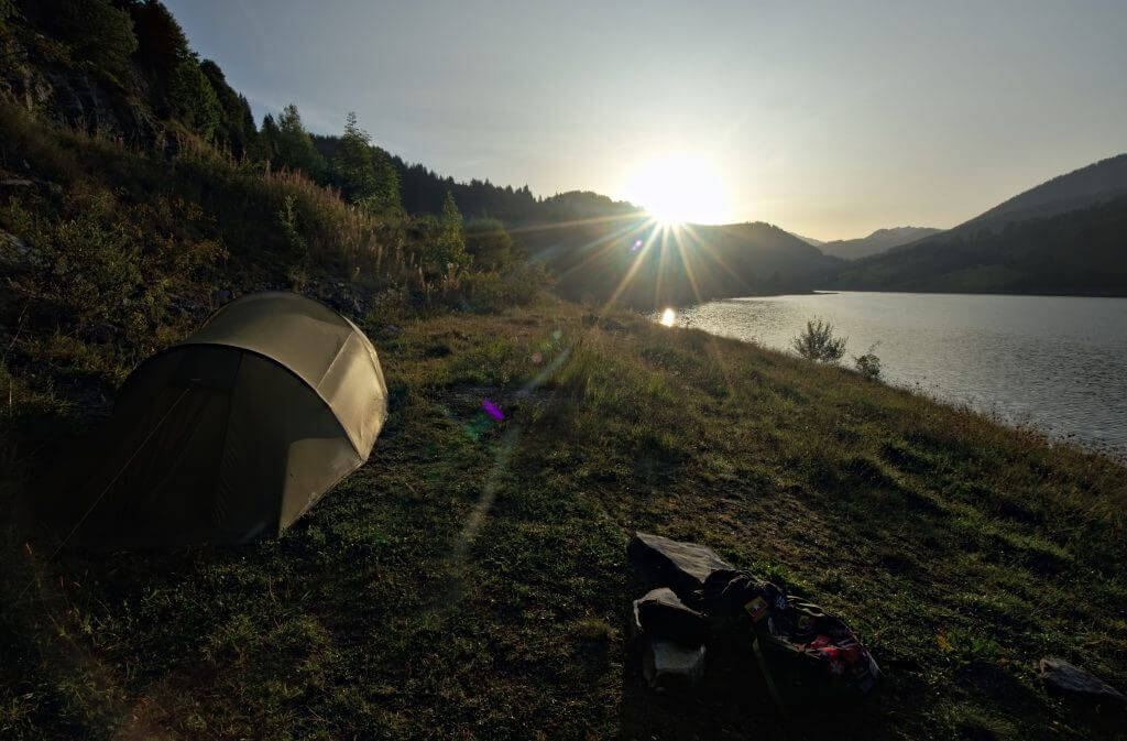
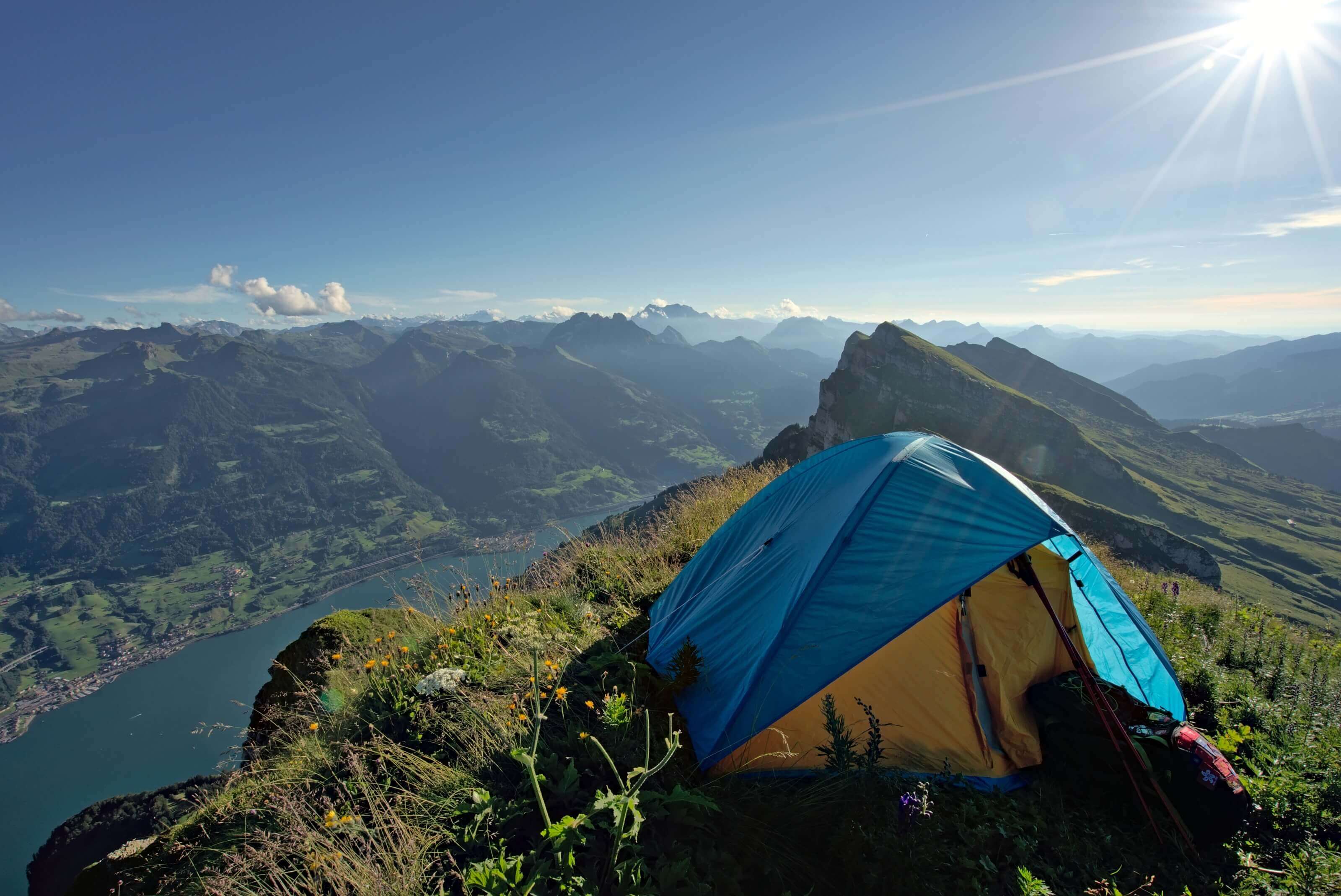
 The alternative is to bring a tent! This is the option we have chosen. We were able to alternate the inns with nights in bivouacs but also nights camping. In the more upscale ski resorts like Grindelwald or Gstaad, hotel prices quickly tend to be a bit crazy, but we still wanted a nice hot shower when we arrived. In short, camping was a good alternative! On average it costs 30CHF - 35 CHF per night in camping (price for 2 people with a tent and without vehicle).
It is totally possible to do the Swiss via alpina by wild camping, but if you decide for this option it is really important to respect "the rules of the game". We are lucky that in Switzerland wild camping (also said bivouac) is tolerated outside natural reserves. it is really essential that we " care " for this privilege by preserving the space in which we decide to set up our camps for the night.
We have detailed the different regulations of the bivouac in Switzerland in our final post of the via alpina here.
We got so many questions about bivouac and wild camping that we decided to writ a complete guide about this:
read our guide about bivouacking and wild camping
Why don't we give the exact GPS coordinated of our camping spots?
You will have noticed it but our blog posts and on our maps we remain vague on the exact location of where we pitched our tent. If you watch our videos and you are a minimum resourceful you will have no trouble finding the exact location.... But why not give the GPS coordinates of our spots? Well for the simple reason that the bivouac is not camping... We systematically asked the local farmers for permission to pitch our tent when we were in the mountain pastures, we searched and moved our tent. The bivouac must remain "a discipline" where the hiker must use common sense to choose his location according to the conditions of the moment and the encounters (and herds) and not settle in a place "planned in advance". So don't be afraid to leave with your tent, you will always find a place to stay! And if you find the perfect spot, share it with your friends but don't publish it online... it would be a shame to see "camping forbidden" signs blooming in dream places just because there have been some abuses!
Traveling in Switzerland has the reputation of being expensive... so we won't lie, our small country is far from being cheap, but the good news is that walking is probably the cheapest way to see it!
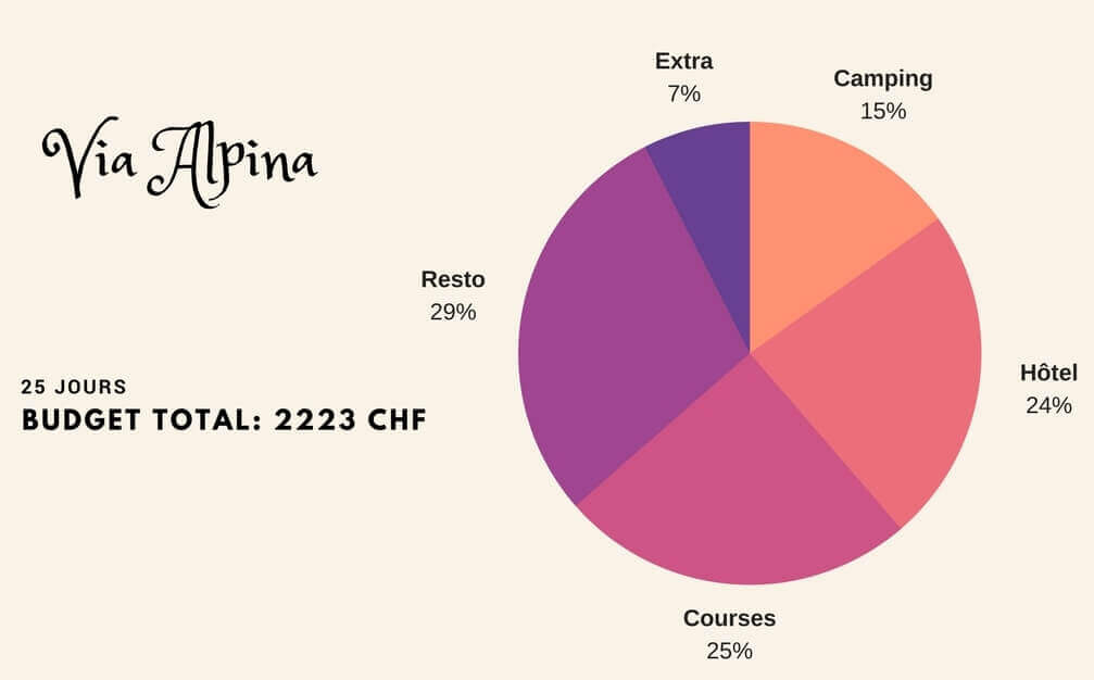
We have devoted an entire article to our budget (Find it here). But if we take the key figures here, it gives a budget of 2223 CHF (about 1975€) for 2 people and 24 days.
We clearly didn't try to do it "the cheapest way" during this trip in the sense that we treeted ourselves with some good restaurants on the way (to cheer us up) but also nights in hostels and B&Bs on nights when the weather was really too bad.
Translatation: The figure below is in french... But here are the details:
Camping = nights we spent on official campgrounds
Hôtel = our budget for refugees, hostels and B&B
Courses = Groceries: bought in local supermarket or directly at the farms
Resto = Restaurants
Extra = all small things that did not fit in neither the above categores (sun screen bought on the way, a hat, cable car)
We have written a very detailed post about our gear on multi day hikes that you can find here. You will see it in this article but we clearly didn't go into "ultralight" mode:)
We left for more than 3 weeks and decided to take our computers, our tent, sleeping bags, etc.... in short, rather than give you the complete list in duplicate here I let you go read the article.
Here I would like to talk to you about some "essential" things that we wouldn't necessarily think of but that have been really useful to us!
 : the Swiss water is perfectly clear and pure but in the mountain pastures you still have to be a little careful, especially if there are cattle. In short, rather than asking us a thousand questions to find out whether or not we could drink the water found on the way, we opted for a filtering bottle. Our best purchase for this trek, without hesitation! Every morning we each left with 6dl of water (much lighter than having to plan for water reserves for the day) and we filled up as we went along.
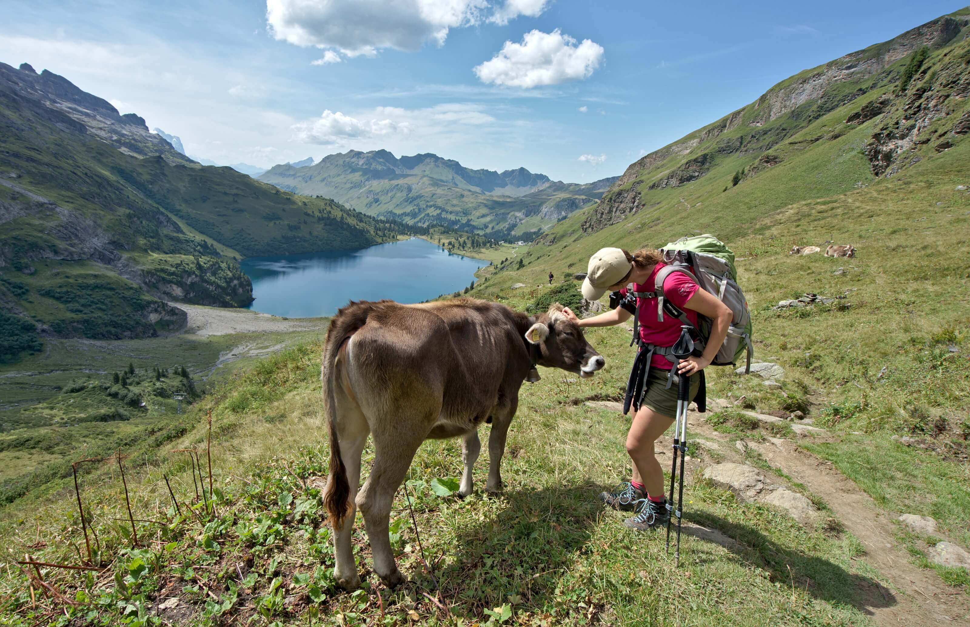
As I said at the beginning of the article, for us the Via Alpina was a form of challenge! We wanted to cross our country "in one go". But as Switzerland is a very populated country, we pass very regularly through villages during this hike. This is practical on the one hand for buying food supplies but it also makes it possible to do only certain sections (almost all Swiss villages are accessible by public transport).
It is difficult for us to choose only 1 section1, but we have regularly been asked which end we would choose if we had only had 4-5 days.
To this question I often tend to answer the same option... one that will make your legs hurt like crazy, but which will also leave you speachless!
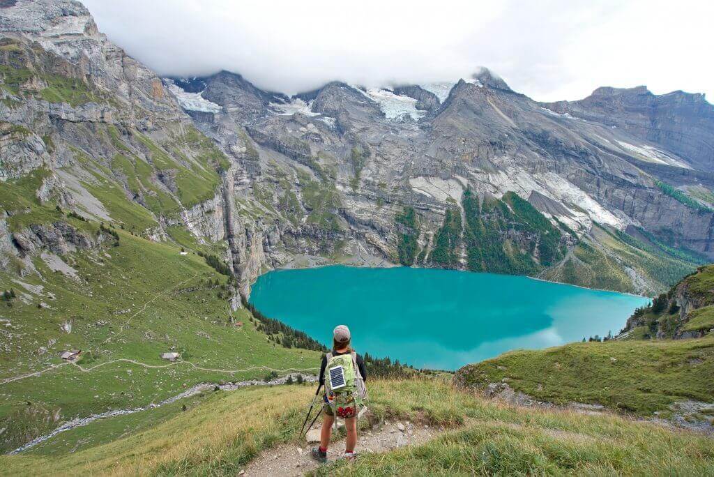
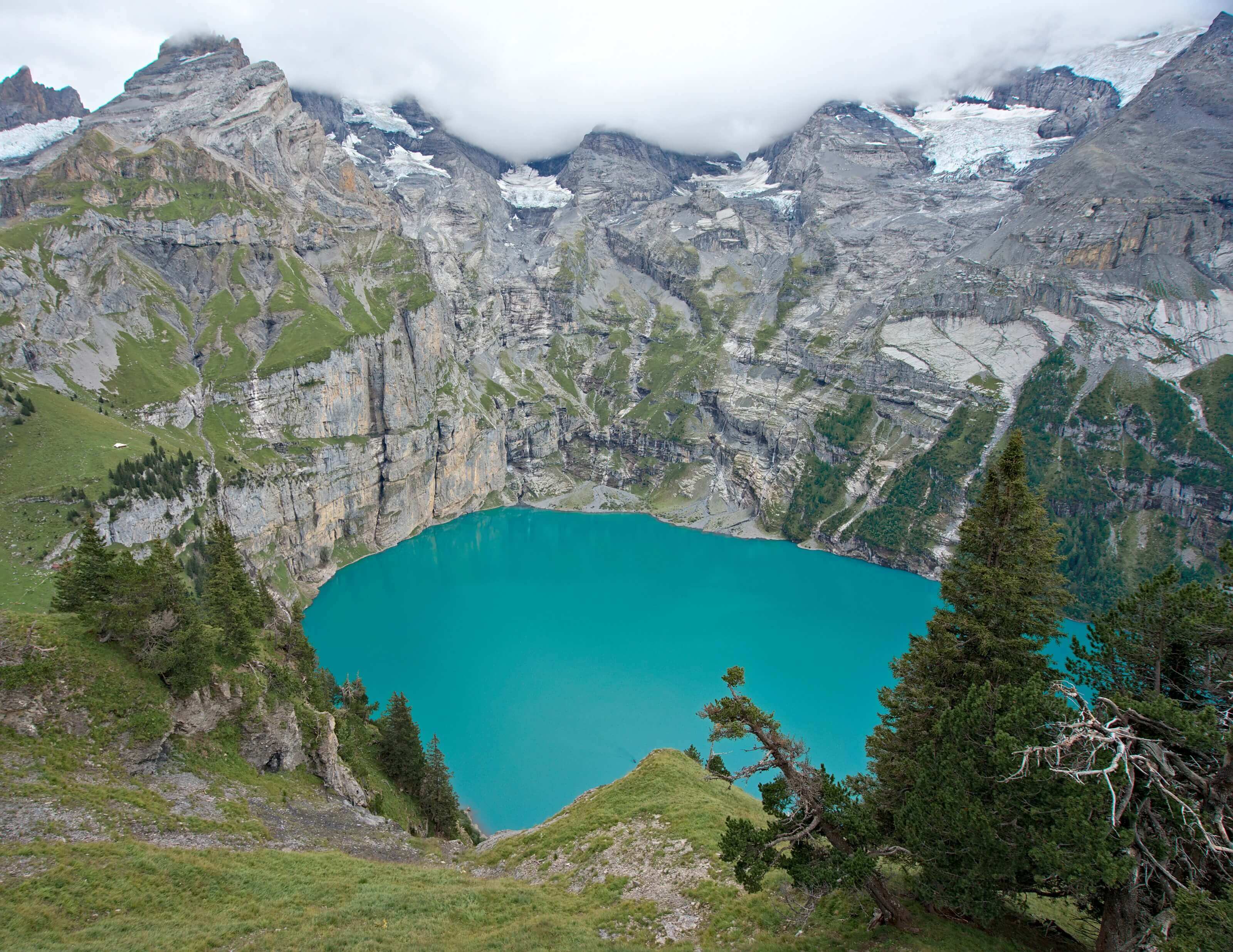
This route is 56km long with 4850m positive altitude difference and 4350m of negative altitude difference. If you follow the official steps of the Via Alpina it takes 3 days.... But personally I think it's a little too sporty.... Four days seems much more reasonable to me! If you want to read more about this step, we invite you to read our article about the Lauterbrunnen-Kandersteg section. The highlight of this section is clearly the magnificent Lake Oeschinen!
It is (in theory) possible to stop at Kandersteg, but we have added the end that goes to Adelboden because the stage passing the Bunderchrinde pass is absolutely stunning.
Our brand new guide and ebook on the Swiss Via Alpina has just been released! A digital book that contains everything you need to know to prepare this beautiful 380 km trek through the Swiss Alps.
How much did we spend during our Via Alpina? We tell you everything about the budget to plan to cross Switzerland on foot
We take you with us on the last kilometers of this Swiss Via Alpina, between Kandersteg and Montreux with the magnificent arrival at Les Rochers de Naye
First impressions after returning from the Swiss Via Alpina. We followed the green route from Sargans to Montreux through the Swiss Alps.
We take you with us to the 2 highest passes of the Swiss Via Alpina: the Sefinenfurgge and Hohtürli passes between Lauterbrunnen and Kandersteg.
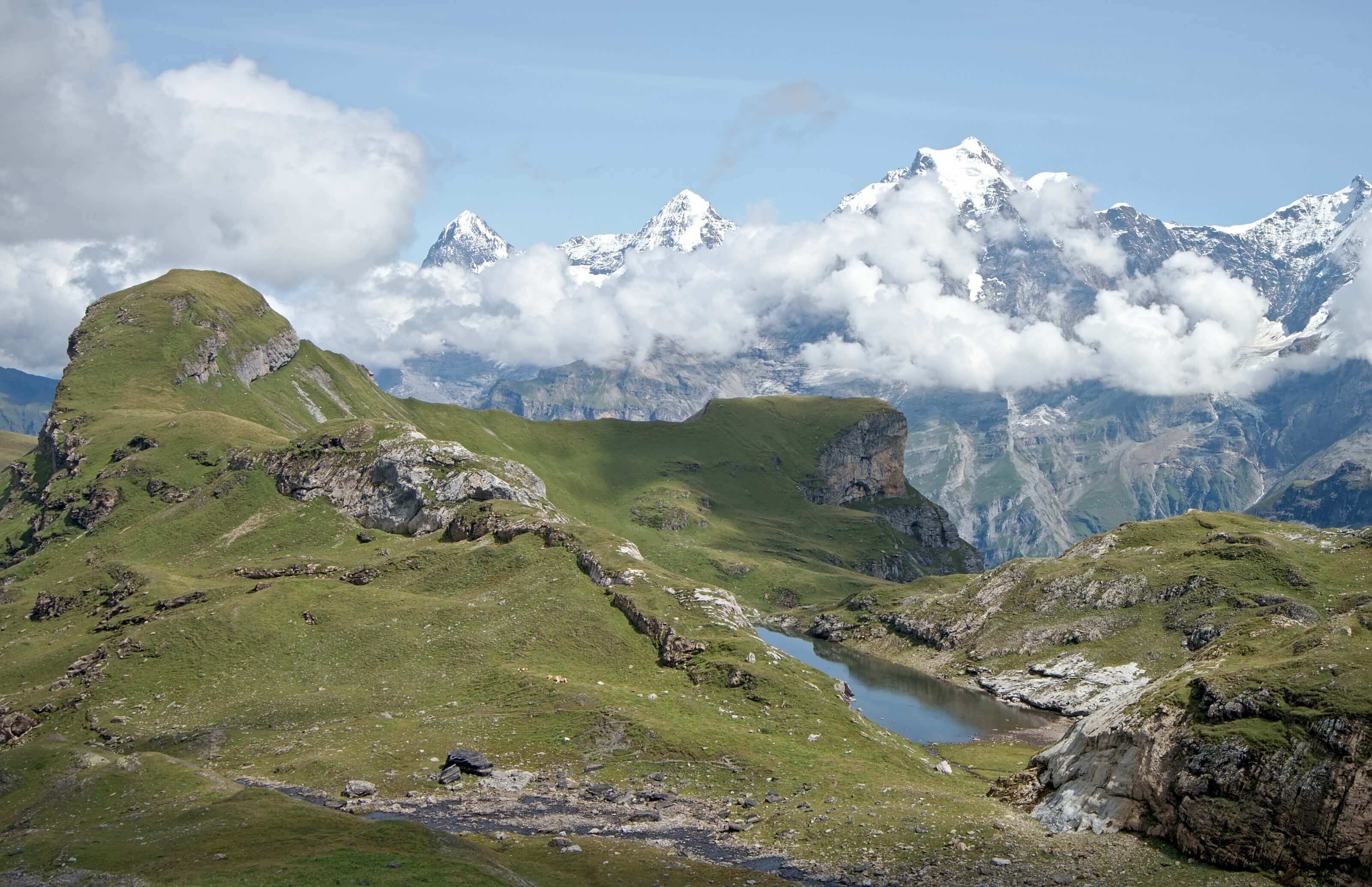
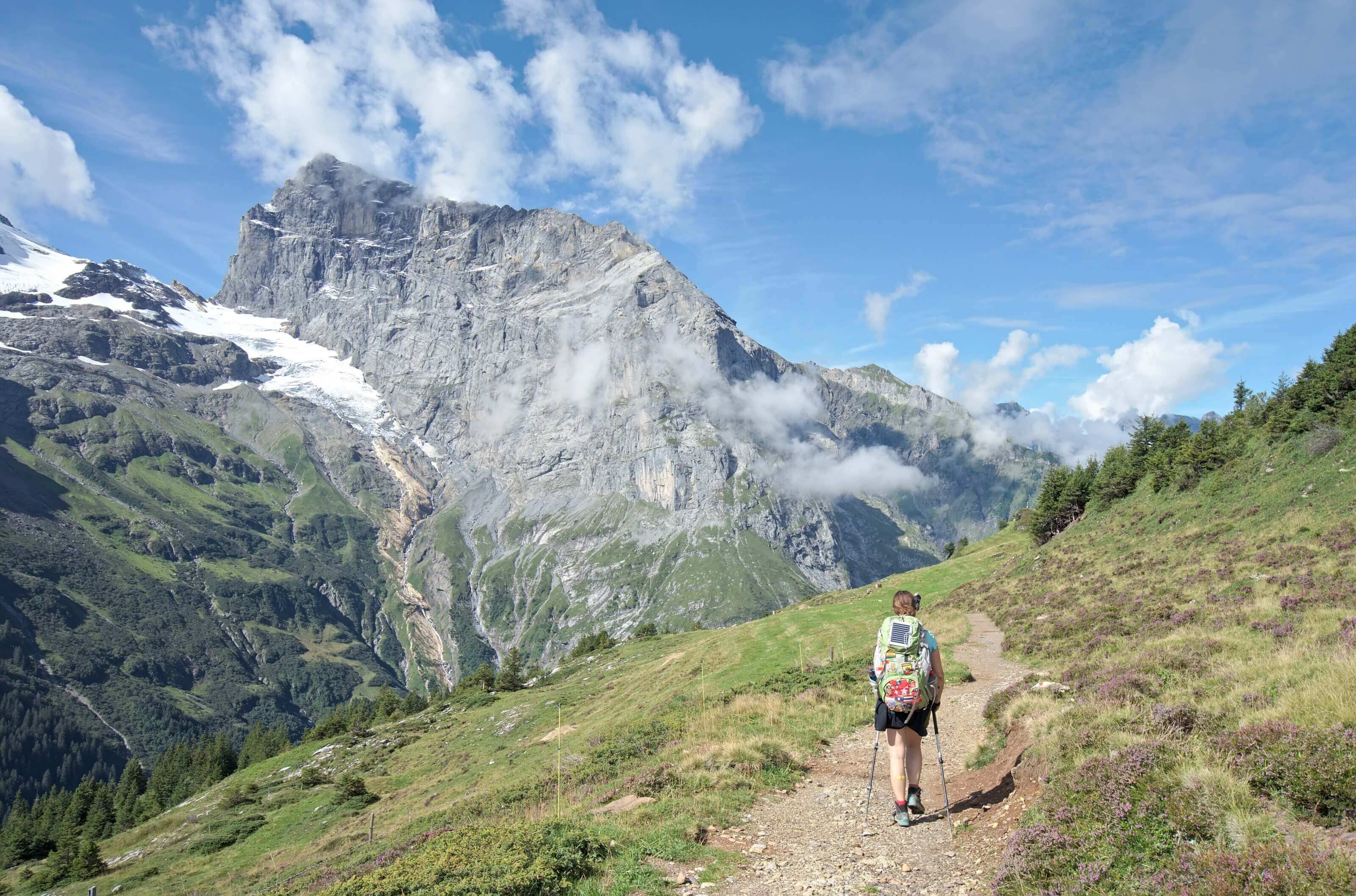
4 fantastic stages of this Via Alpina on which we discovered some of the most beautiful mountains in Switzerland such as the Eiger and Jungfrau
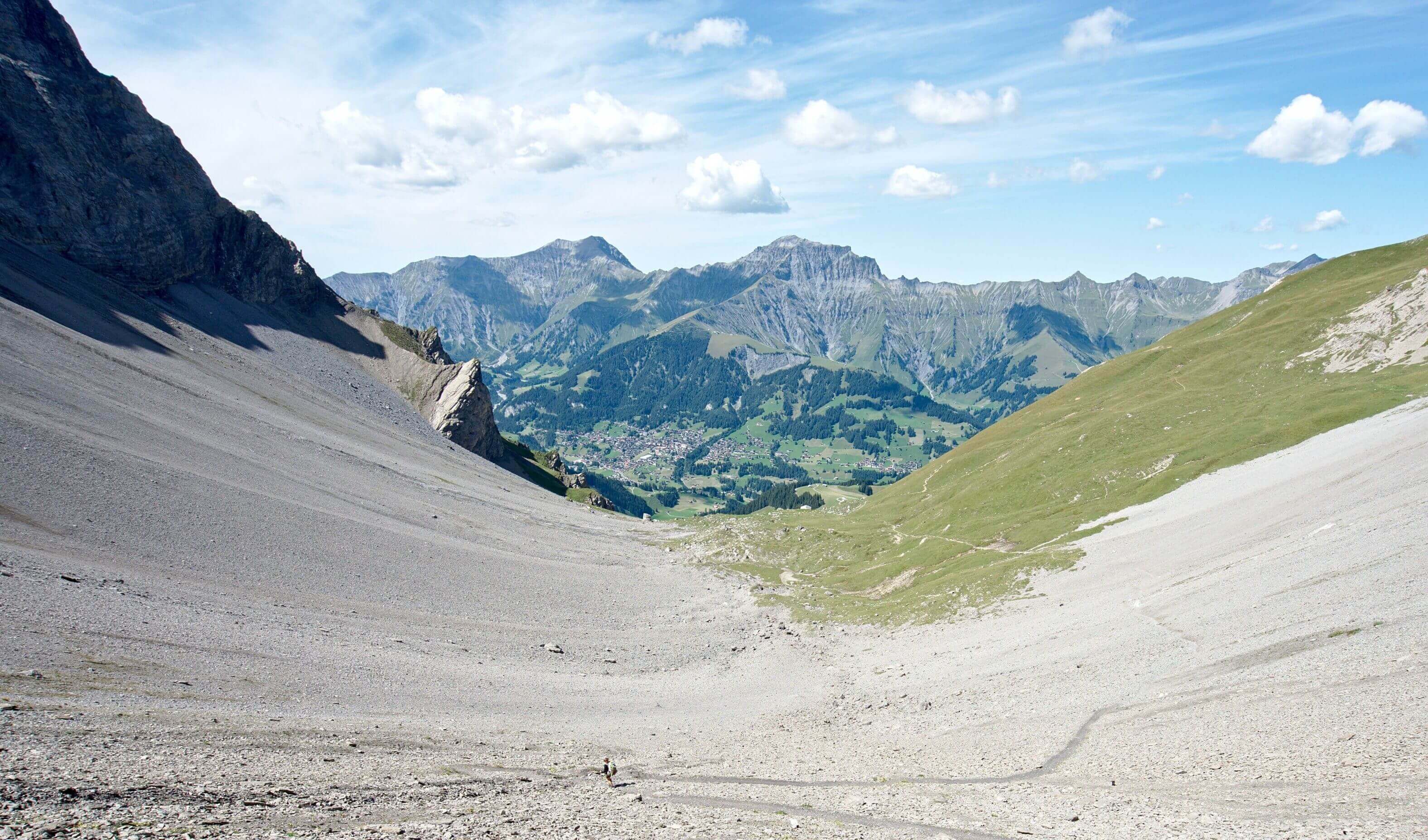
Our first week of hiking on the mythical Swiss Via Alpina. 100 km rich in emotions from Sargans to Engelberg - travel diary
Walking through Switzerland via the Alps on the Via Alpina is a great challenge. Here are the reasons why we decided to embark on the adventure